Friday, May 23, 2025

Remembering Hurricane Irene in Photos

Share post:

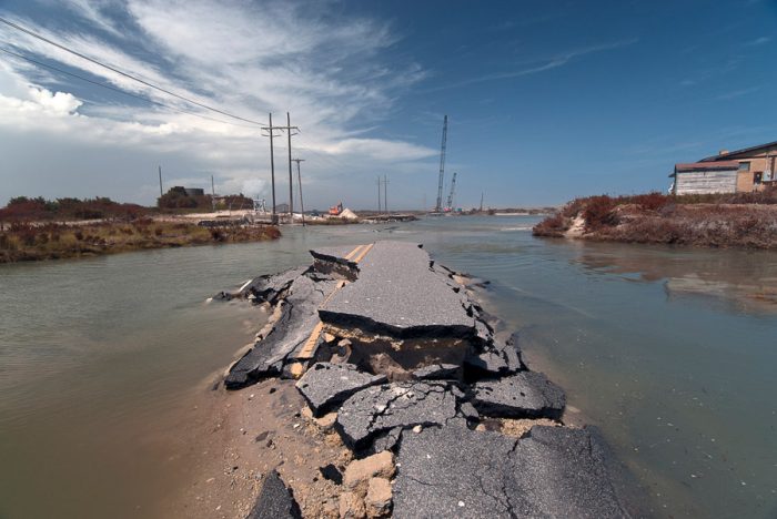
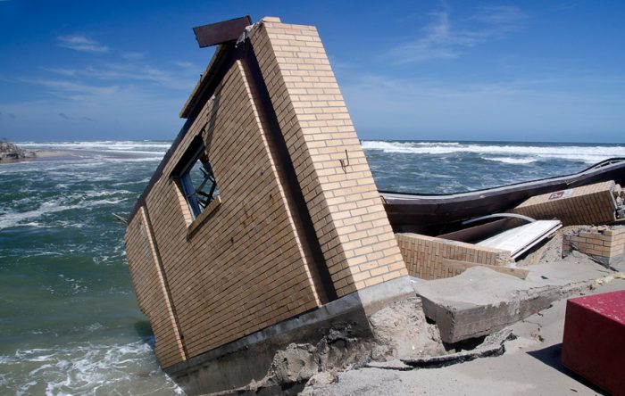
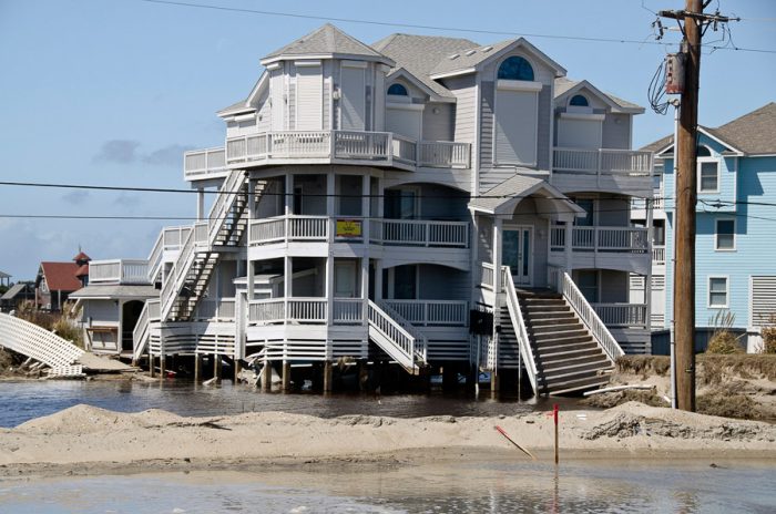
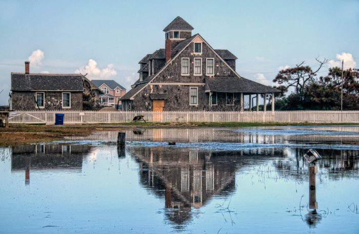
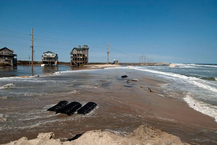
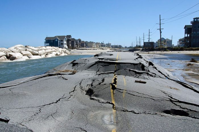
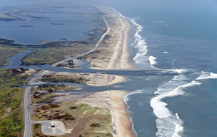
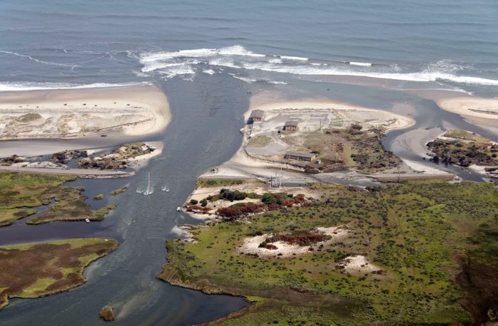
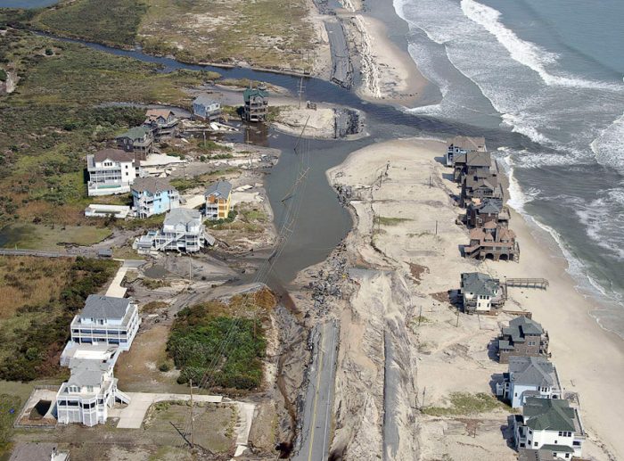
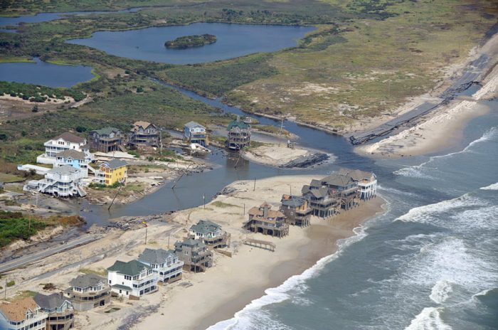
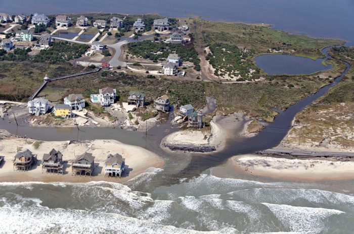
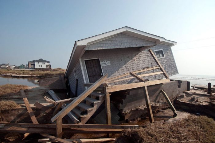
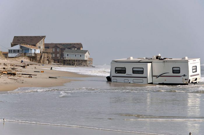
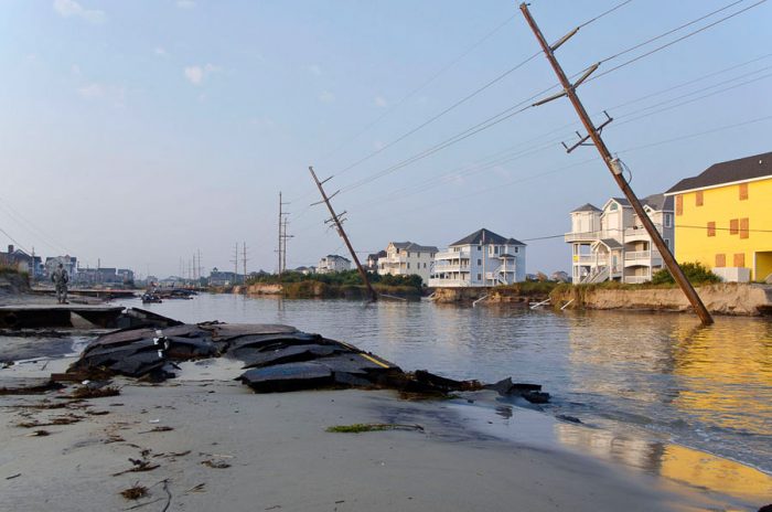
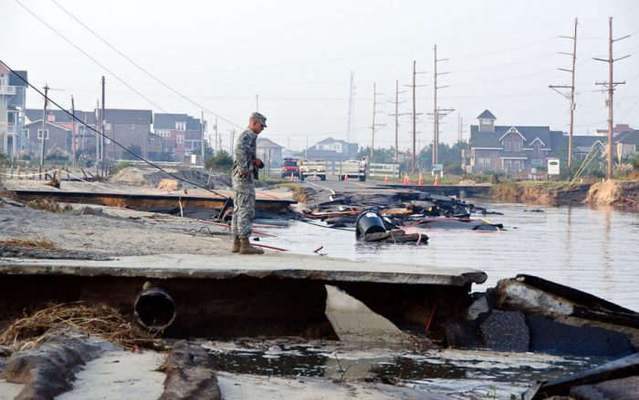
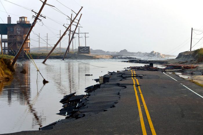
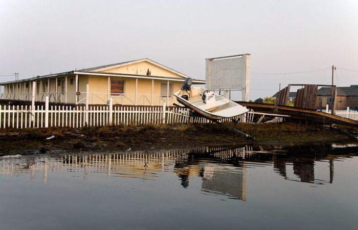
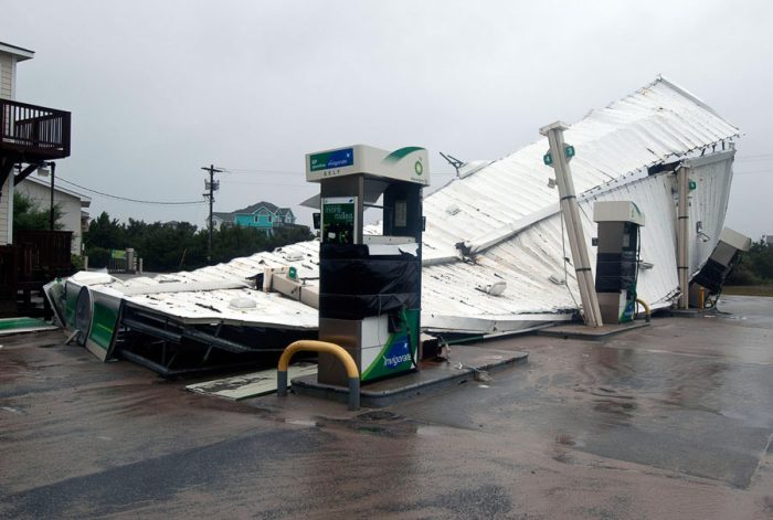
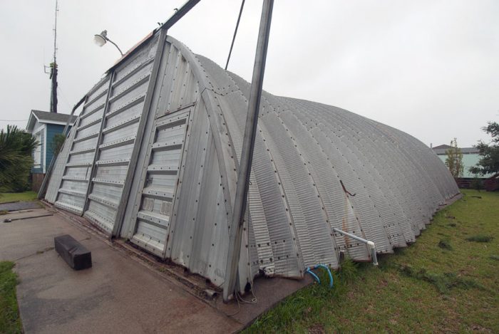
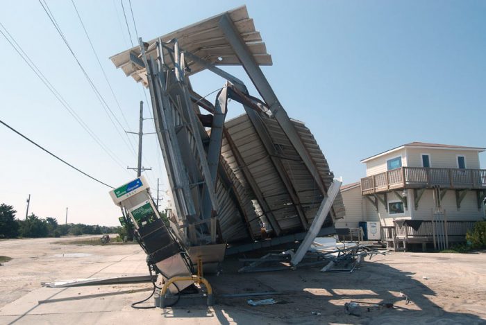
August 27 marked 10 years since Hurricane Irene made landfall near Cape Lookout, N.C., as a Category 1 storm, bringing significant soundside flooding to northern Hatteras Island and the Outer Banks.

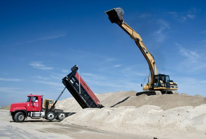
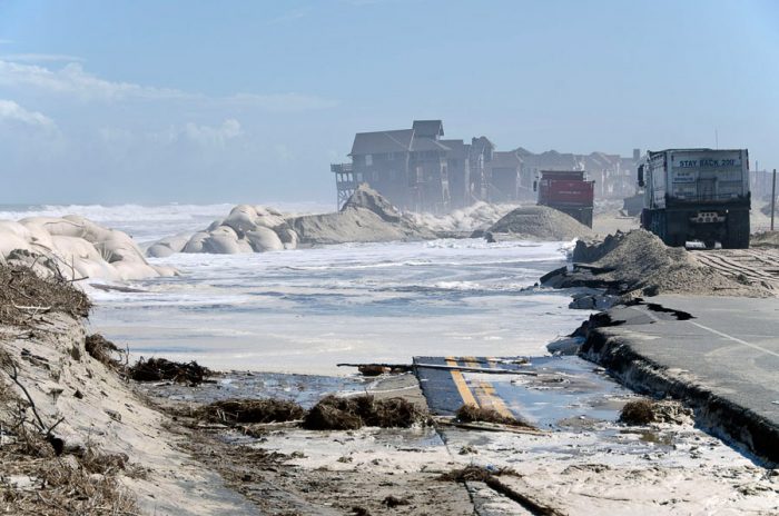
The approximate 12 ft. of storm surge, (per National Weather Service records), resulted in the formation of two new inlets on Pea Island, in addition to multiple dune breaches, power interruptions for more than a week, and the closure of N.C. Highway 12 from September 27 through October 10.

Island Free Press reporters and photographers covered the storm from its initial landfall to the reopening of N.C. Highway 12 weeks later, and a collection of their images show the true extent of Irene’s damage.

For more information on how Irene changed the Outer Banks landscape, see https://islandfreepress.org/hatteras-island-features/how-hurricane-irene-changed-the-outer-banks-10-years-later/.

Trending

Subscribe

Help Support Local News! Subscribe for Free, Upgrade to Premium, or Make a Contribution.

Related articles

What’s the plan for Ocracoke’s vulnerable South Dock ferry terminal? NCDOT wants public input

Public comments were encouraged at two open-house-style meetings that shared potential solutions to the Hatteras-Ocracoke ferry’s troublesome South...

Cape Hatteras Electric celebrates SHARP renewal at annual meeting with record-breaking attendance

The Cape Hatteras Electric Cooperative (CHEC) had record-breaking attendance at its 80th annual membership meeting, which was held...

Slash Creek Bridge in Hatteras Village opens to traffic

The new Slash Creek Bridge in Hatteras Village opened to traffic on Thursday evening, a day ahead of...

Fessenden Center Gymnasium reopens after completion of roof & siding replacement project

The Dare County Parks and Recreation Department’s Hatteras Island Division has announced that the gymnasium located inside the Fessenden Center (46830 N.C....