Florence Continues to Strengthen and is Forecast to Make Landfall as Major Hurricane
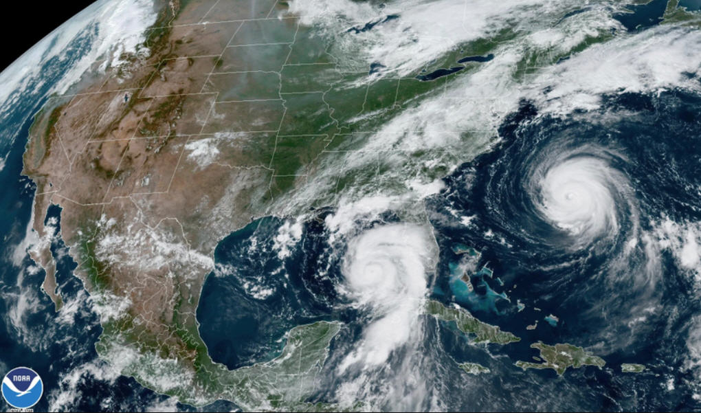
Florence continues to strengthen with an increasing risk of life-threatening impacts for coastal North Carolina, including storm surge and widespread rainfall totals in the 6-12 inches range, per the Monday morning update from the National Weather Service Newport / Morehead City office.
Florence was a Category 2 Hurricane with winds of 105 mph as of Monday morning.
Tropical storm force winds are most likely to arrive in the Outer Banks Thursday morning, but could arrive as early as Wednesday evening. Landfall in the Carolinas is forecast to be sometime Thursday night as a major hurricane, although significant changes to this timing are possible based on forecast track and motion changes.
The chances of tropical force winds due to Florence is close to 80% for Hatteras and Ocracoke islands. A high threat of dangerous rip currents for all Eastern North Carolina beaches is in effect for Monday, and large, dangerous surf is expected throughout the Outer Banks this week. Coastal erosion and ocean overwash is possible again today across the Outer Banks at high tide, due to the king tides.
“Residents and visitors must take this storm seriously and prepare now,” said Dare County Emergency Management Director Drew Pearson in a Sunday press release. “Regardless of the exact track and intensity, it is clear that Dare County is going to feel the effects of a major hurricane. Take precautions now and assemble or restock your disaster supply kit with essentials to sustain your family and your pets for three to five days. Have your evacuation plan ready to execute.”
The Dare County Control Group will meet on Monday, September 10 to begin discussions about potential impacts and whether an evacuation order will be issued.
For preparedness information, visit www.readync.org.
Monitor local weather reports at www.weather.gov/mhx, or sign up to receive email alerts directly from Emergency Management at www.darenc.com/emergencyalerts and follow @DareCountyEM on Twitter.