Fiona will bring dangerous rip currents later this week
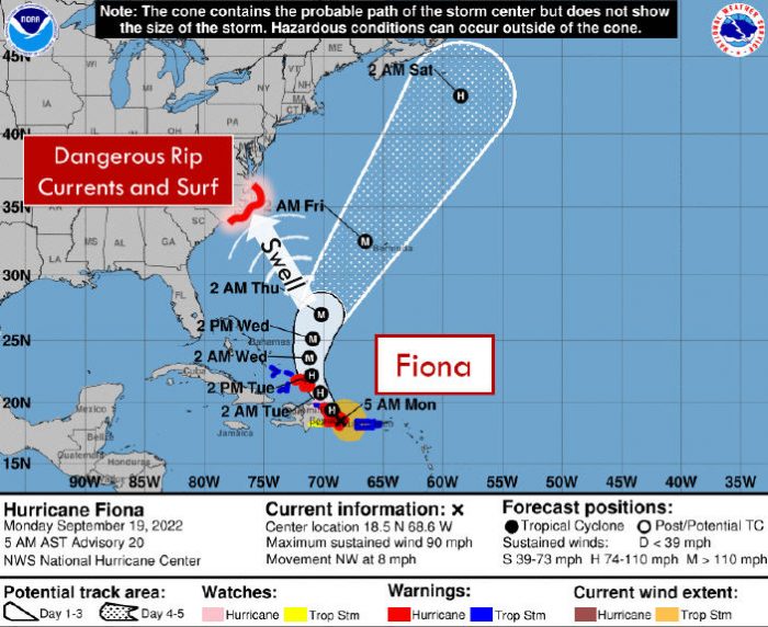
While Hurricane Fiona is expected to bypass the Outer Banks and stay out to sea, due to long-period swell from the strengthening hurricane, there will be an extended period of dangerous rip currents later this week for all Eastern North Carolina beaches.
Per the National Weather Service (NWS) Newport/Morehead City Office, Fiona is forecast to move into the southwestern Atlantic by Tuesday, then eventually turn northeast mid-to-late week as a strong cold front moves off the U.S. East Coast. As a result, a high threat of rip currents is expected Wednesday through Friday for Hatteras and Ocracoke Islands.
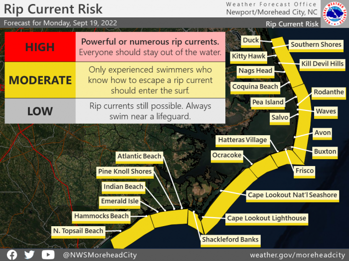
A moderate risk of rip currents is in effect for all Outer Banks beaches on Monday, September 19. A moderate risk means that only experienced swimmers that know how to escape a rip current should enter the surf.
As of Monday at 8:00 a.m., Fiona was located 35 miles SE of the Dominican Republic, and the storm was moving towards the NW at 8 mph. Maximum sustained winds are near 90 mph (150 km/h) with higher gusts. Some strengthening is expected during the next few days after the hurricane emerges over the southwestern Atlantic. Fiona is forecast to become a major hurricane by Wednesday.
For more information on the local forecast, visit www.weather.gov/mhx for general weather information, or the National Weather Service office in Newport / Morehead City’s Facebook page at https://www.facebook.com/NWSMoreheadCity/.
