Coastal Flood Advisory, High Surf Advisory issued due to distant Hurricane Fiona
A Coastal Flood Advisory, High Surf Advisory, and Gale Warning are in effect beginning on Thursday afternoon due to indirect impacts expected from distant Hurricane Fiona.
While Fiona is expected to remain well offshore as it moves up the East Coast, strong long-period swells from the hurricane will result in a period of dangerous rip currents, minor coastal flooding, and hazardous marine conditions, per an update from the National Weather Service (NWS) Newport/Morehead City Office.
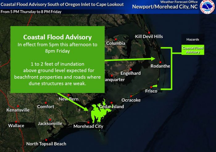
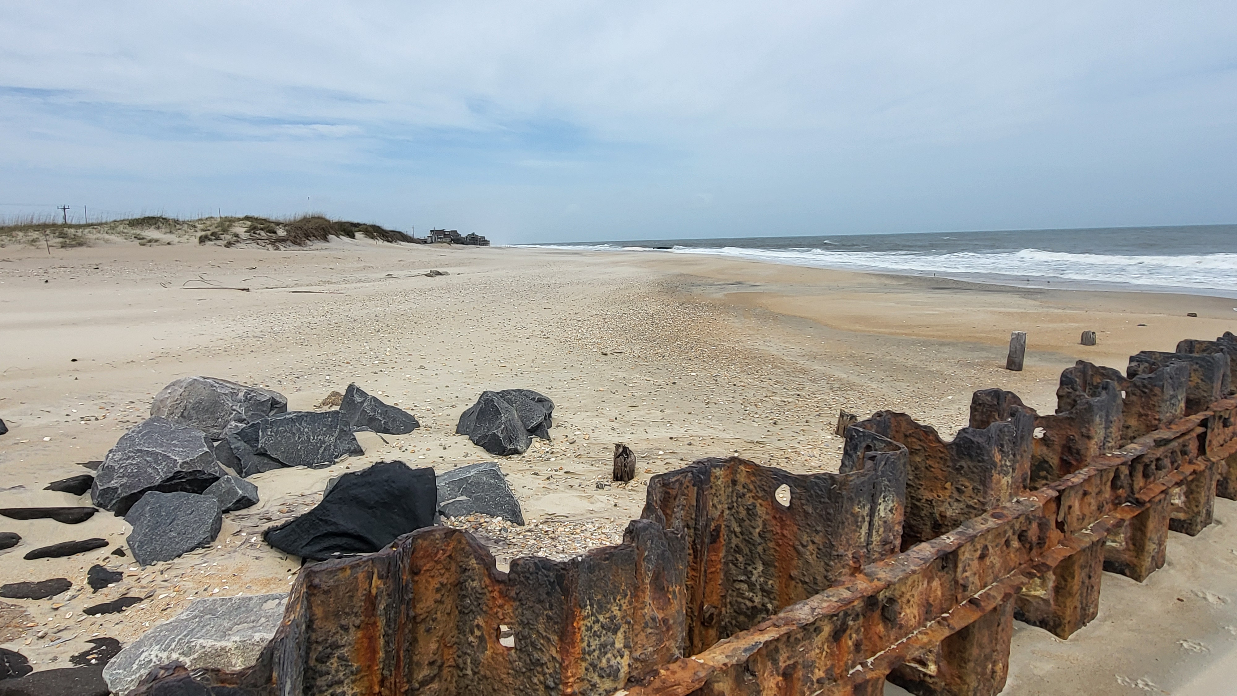
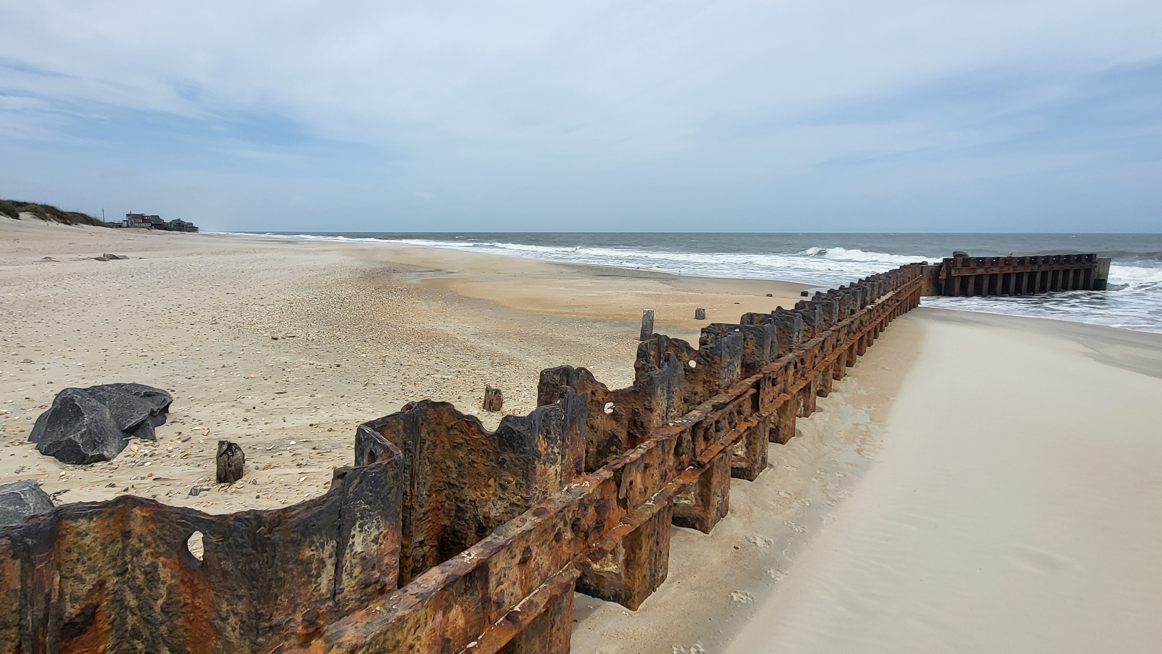
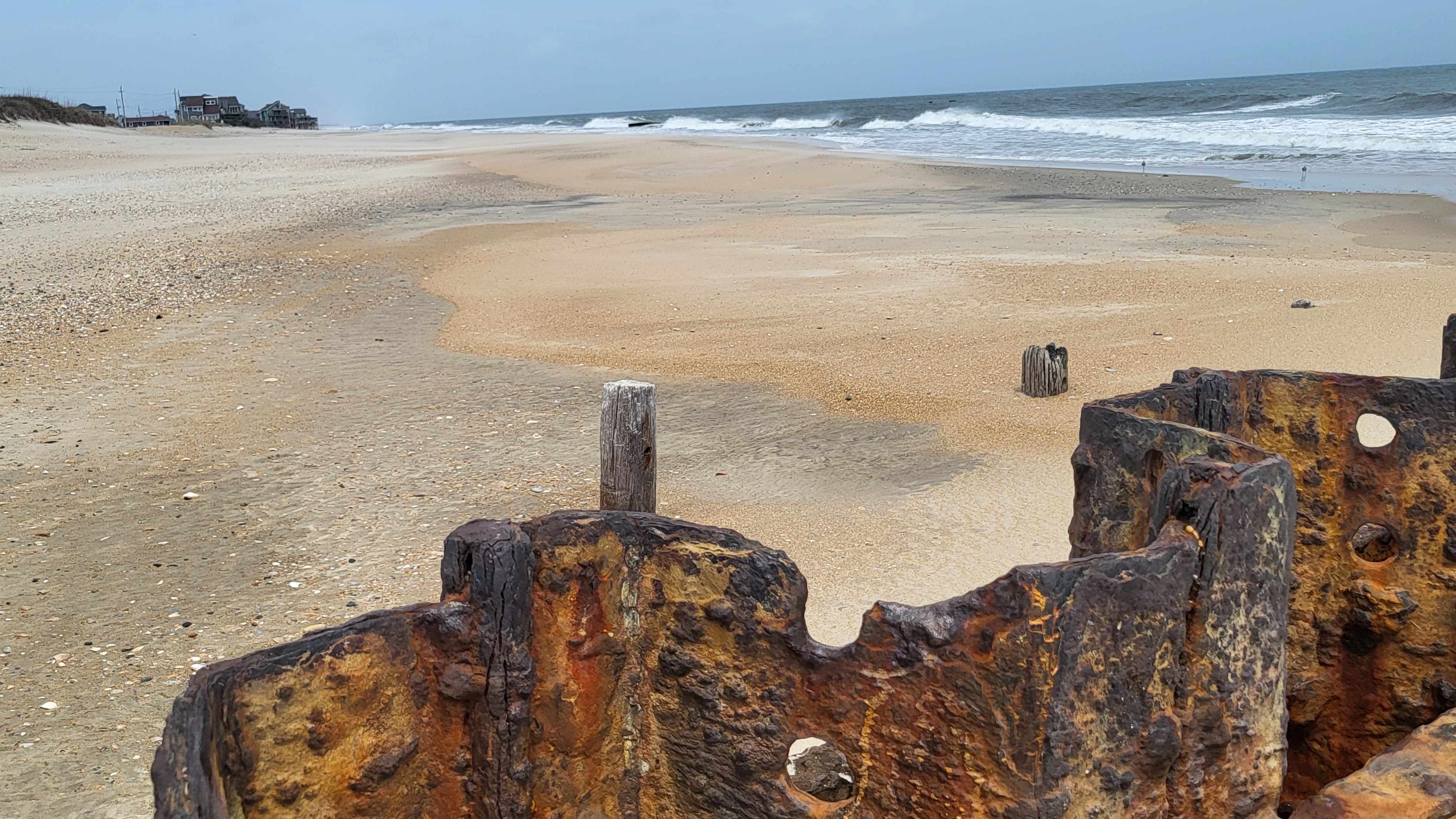
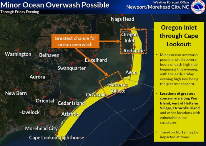
Minor ocean overwash and beach erosion are possible for Outer Banks beaches, mainly south of Oregon Inlet through Cape Lookout. Wave runup from powerful swells could result in 1 to 2 feet of inundation of some beachfront properties and roadways.
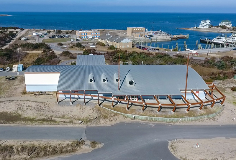
Impacts are possible where dune structures are most vulnerable, and the primary areas of concern include oceanside areas near the Pea Island Visitor Center, Rodanthe, the eastern edge of Hatteras Village, and eastern Ocracoke Island.
The tide of greatest concern is the Friday evening high tide at approximately 6:30 p.m. Overwash issues could also occur with the high tides on early Thursday evening and early Friday morning, and N.C. Highway 12 may be impacted.
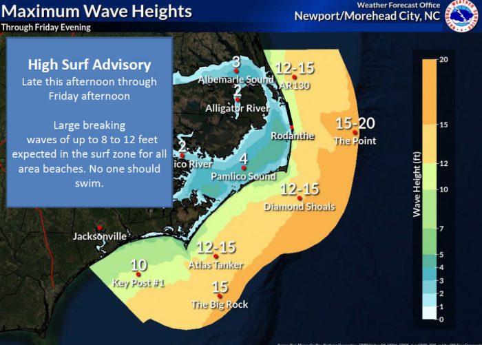
A High Surf Advisory has been issued for this afternoon through Friday afternoon due to large breaking waves of up to 8 to 12 feet in the surf zone for all area beaches.
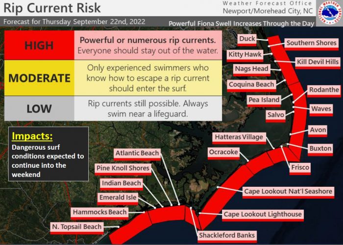
A high risk of rip currents is also in effect for all Outer Banks beaches on Thursday, and the risk is expected to linger through the weekend. A high risk of rip currents means that the surf zone is dangerous for all levels of swimmers, and beachgoers should stay out of the water.
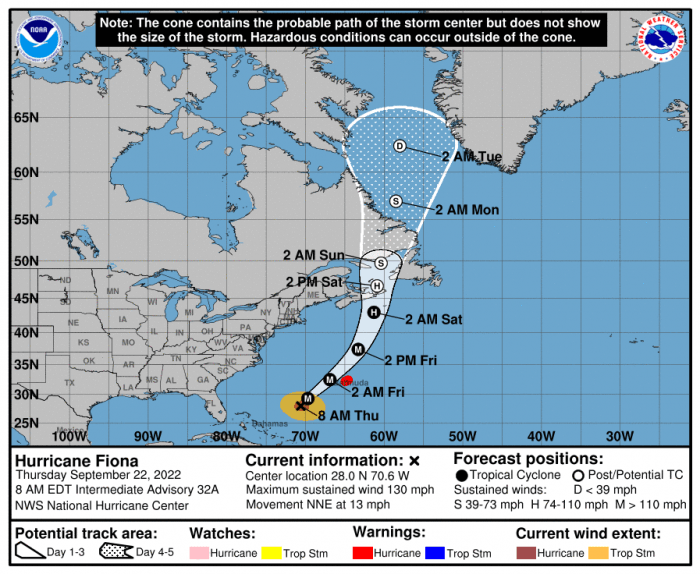
As of Thursday at 8:00 a.m., Fiona was located about 455 miles SW of Bermuda and was moving toward the north-northeast near 13 mph (20 km/h) with maximum sustained winds of 130 mph.
A north-northeastward or northeastward motion with an increase in forward speed is expected today through Friday, followed by a somewhat slower northward motion beginning Friday night or Saturday. On the forecast track, the center of Fiona will pass just to the west of Bermuda tonight, approach Nova Scotia on Friday, and move across Nova Scotia and into the Gulf of St. Lawrence on Saturday.
