Ernesto’s big surf, deadly rip currents, ocean overwash starts to arrive along the Outer Banks
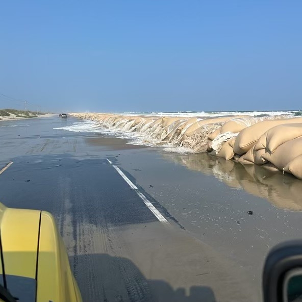
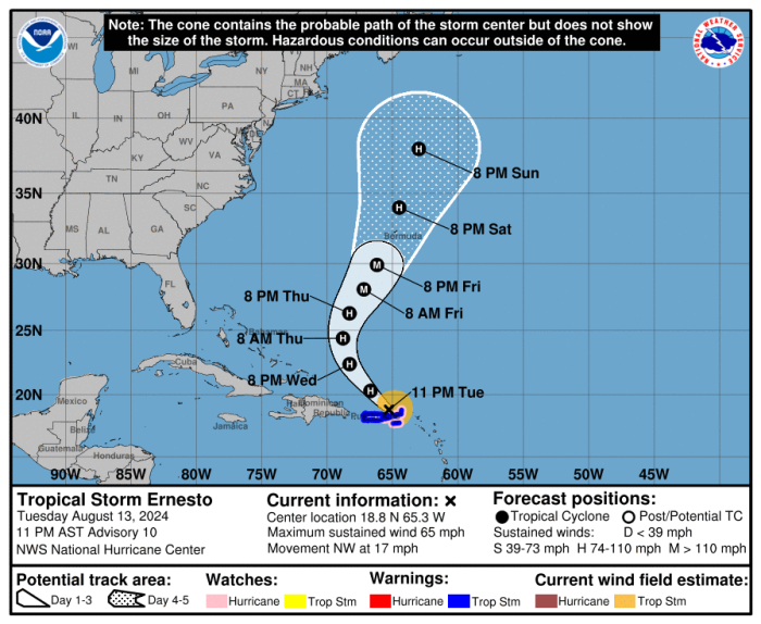
Large swells, dangerous rip currents, and some overwash at high tide started to arrive along the Outer Banks on Friday from distant Hurricane Ernesto, and will continue through the weekend.
The large surf has already claimed another home along the oceanfront in Rodanthe, the seventh to collapse since 2020.
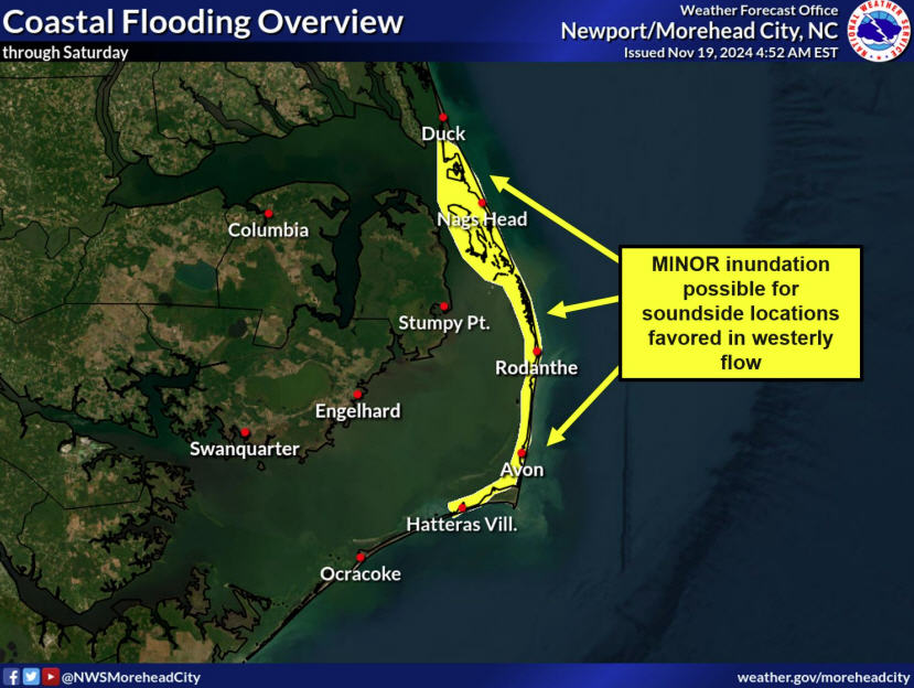
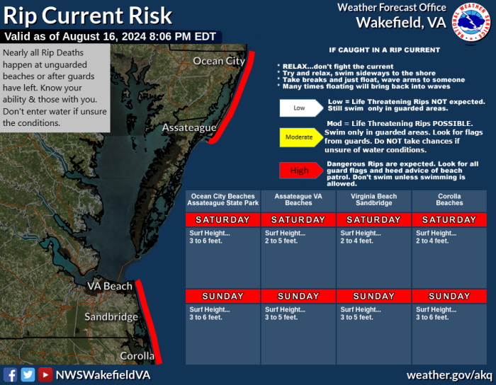
A Coastal Flood Advisory and High Surf Advisory have been issued for Hatteras and Ocracoke islands through early Monday, and a High Risk of rip currents is forecast for Saturday along all Outer Banks beaches.
Along with the bigger waves, there is a full moon and Earth’s lone natural satellite is at the closest point of its orbit known as perigee. That creates a King Tide, a non-scientific term used to describe exceptionally high and low tides over multiple consecutive days.
Overwash was reported along the vulnerable oceanfront area along N.C. 12 at the north end of Ocracoke, and on the stretch of old N.C. 12 at Mirlo Beach, with Friday evening’s high tide.
More overwash is possible with high tide on Saturday around 6 a.m. and 7 p.m., and on Sunday around 7 a.m. and 8 p.m.
“Additionally, visitors are urged to use caution while walking on the beach or participating in water activities at the north end of Rodanthe, due to the presence of threatened oceanfront structures,” said Cape Hatteras National Seashore.
That is the same area where a home at the end of Corbina Drive collapsed Friday evening.
While the weather forecast is for near-perfect conditions to be on the beach on Saturday and into Sunday, it will not be a good weekend to enter the ocean.
With the high-energy, long period swells, there will be large waves breaking in the surf zone and numerous rip currents.
And the King Tide will also enhance the rip currents with lower than normal tides around 12 p.m. on Friday, midnight and 1 p.m. on Saturday, and 1 a.m. and 2 p.m. on Sunday.
A similar situation happened in 2019, when Hurricane Lorenzo passed more than 2,000 miles off the North Carolina coast and lead to more deaths than were experienced with Hurricane Dorian which crossed directly over the Outer Banks with record-breaking flooding that same year.
A list of local Outer Banks resources for information is below.
- For alerts and notifications from Dare County on a customizable list of events or emergencies, (including hurricane evacuations and updates), visit https://www.darenc.gov/departments/emergency-management/emergency-alerts.
- For rip current information and other beach hazards, sign up for text alerts from Dare County, ocean rescue agencies, and the National Weather Service by texting “OBXBeachConditions” to 77295.
- For real-time flood maps that show water level rises throughout Hatteras and Ocracoke Islands, (as well as optional alerts), visit the NC Flood Inundation Mapping and Alert Network.
- For information on the local forecast, visit weather.gov/mhx for general weather information, or the National Weather Service office in Newport/Morehead City’s Facebook page at https://www.facebook.com/NWSMoreheadCity/.
- For up-to-date information on tropical conditions, follow the NWS at gov/mhx/tropical or visit the National Hurricane Center’s website. Just pay attention to all info, and not just the cone graphics.
- To sign up for the Special Needs Registry for hurricane assistance through Dare County, visit https://www.darenc.gov/departments/health-human-services/special-medical-needs-registry or call 252-475-5599.
- For Dare County hurricane information, including reentry procedures, visit https://www.darenc.gov/departments/emergency-management/hurricanes.
- For updates regarding road conditions, visit DriveNC.gov and follow the North Carolina Department of Transportation and NCDOT NC 12 on Facebook. The Dare County Sheriff’s Office also shares local road condition updates on its Facebook page.
- To get notified of ferry delays or cancellations, sign up for text and/or email alerts via the N.C. Ferry System’s FINS system: www.ncdot.gov/fins.
- For up-to-the-minute local information on hurricanes, as they happen, listen to Radio Hatteras at 101.5 (Avon through Hatteras) and 99.9 (Tri-villages), or visit them online at https://www.radiohatteras.org/.
- For online news coverage on active storms, continue to check the Island Free Press.


