Winter storm arrives late Friday with a mixed bag of precip, best chance for snow away from the water
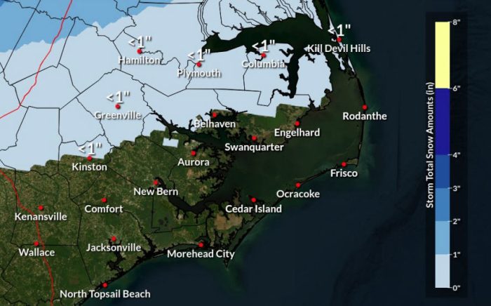
A massive winter storm moving across the country Friday and Saturday is expected to bring most of northeastern North Carolina a blast of wintry precipitation.
But as is typical with coastal lows such as this one, the region is going to be sharply divided between areas that see mostly snow, a mixed of frozen precipitation and all rain, as well as a rapid shift from one type to the other as the storm passes offshore.
“I know some people, including myself, are a little disappointed we couldn’t get some snow with all this cold air across our area,” said Erik Heden, Warning Coordinator Meteorologist at the National Weather Service office in Newport Morehead City said in a video posted Thursday night.
“Towards the coast, maybe we see a few snowflakes, but not expecting measurable snow,” Heden said.
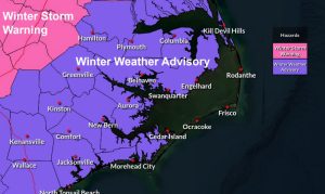
The National Weather Service has issued a Winter Weather Advisory for the beaches from Carova to Oregon Inlet and the mainland areas in the northeast corner of the state.
“Bottom line, an advisory means a nuisance,” Heden said. “It’s not to not pay attention to it. It just means it won’t be as impactful as a warning, which is more of an impactful event in terms of snow or ice.”
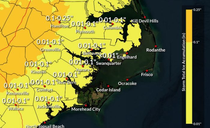
The latest forecasts have been backing off the ice potential for our areas.
“We’re not talking a lot of ice. In fact, some of it will be sleet. It won’t be all just freezing rain,” Heden said. “But if we’re going to see higher ice amounts, it’s certainly up toward I-95 and places to the north and west.”
Corolla and much of mainland Currituck are expected to see a mix of precipitation, with total snow and sleet accumulations of up to two inches.
But don’t expect the snow to stick around very long in those areas.
The latest forecast from NWS Wakefield for most of those areas says precipitation will begin as a mix of rain, snow, and freezing rain from 7 p.m. to 2 a.m., a mix of rain and snow between 2 a.m. and 3 a.m., then all rain after 3 a.m. before ending around 10 a.m.
However, the closer to the state line you get, the more likely there is less rain mixing in.
From Duck to Oregon Inlet, NWS Newport calls for rain beginning around 7 p.m. Friday, mixing with some sleet, snow and freezing rain starting around 1 a.m. Saturday until daybreak, when it becomes all rain and ends by mid-morning, washing away any accumulation.
South of Oregon Inlet, rain mixed with sleet and snow is forecast from 7 p.m. Friday through 4 a.m. Saturday, followed by just rain that moves out by 1 p.m.
Due to the fast-moving track of the storm, no coastal impacts are expected other than northwest winds to gale force over the offshore waters on Saturday.
“I’m not overly concerned with power outages,” Heden said. “The wind speeds are going to be light.”
The Dare mainland, Tyrrell and Hyde counties will see a mix of rain, sleet and snow starting around 7 p.m. Friday through 6 a.m. Saturday, and then all rain lasting through around noon.
Travel will be much more treacherous to the west, and due to the winter weather threat, inauguration festivities for Governor Josh Stein scheduled for this weekend in Raleigh have been cancelled.
The best chances of snow from this system are in southeastern Virginia, where 1 to 3 inches of snow is possible in southside Hampton Roads and as much as 4 inches along the upper Peninsula and parts of Suffolk.
Once the storm gets out of here, we’ll see dry conditions and clear skies, with temperatures dropping below freezing.
“Anything lingering in terms of wet roads, especially wet bridges, Saturday night will refreeze into black ice,” Heden said.
