Cleanup of fallen house begins; beach near site closed
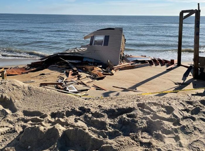
Cleanup of the house that fell into the ocean last week on a rapidly eroding stretch of Outer Banks beach has begun, now that National Park Service officials have approved the necessary permit.
The work means that the section of beach on the Cape Hatteras National Seashore near the site of the house in Rodanthe is temporarily closed.
With debris spread along about 15 miles of beach to the south of the collapsed house site, area residents are invited to help with the beach cleanup on a drop-in basis. Volunteers will be provided with gloves, garbage bags and trash pickup sticks by the National Park Service for the organized effort. To receive supplies, volunteers should meet National Seashore rangers at either the Outer Banks KOA Resort at 25099 N.C. Highway 12, Rodanthe, or off-road vehicle ramp 23, just south of the village of Salvo.
Officials said Sunday that much of the wood pieces that have washed up on the beach have exposed nails, so all volunteers are encouraged to wear thick-soled footwear. Children under the age of 18 must be accompanied by a parent or legal guardian.
“We are very appreciative of Dare County residents and Seashore visitors who have pitched in from day one of the house collapse by picking up and moving large amounts of debris to above the high tide line,” said National Parks of Eastern North Carolina Superintendent David Hallac in a statement. “Additionally, we are thankful to the Outer Banks KOA Resort and North Carolina Beach Buggy Association for partnering with the Seashore.”
Volunteers should place garbage bags and debris above the high tide line to ensure the items don’t get washed back into the ocean.
Park Service officials said Friday that the owners of the house had submitted a removal plan and hired a contractor to complete an extensive cleanup of the house and “many miles” of National Seashore beach.
“After a careful review of the plan, the Seashore this morning issued the homeowner a special use permit to immediately begin removal work,” officials said.
The owners of the house hired W.M. Dunn Construction, LLC of Powells Point to remove the house and all associated debris. National Park Service rangers have observed debris along about 15 miles of beach to the south of the collapsed house site.
“The large debris field from the fallen house poses a risk to Seashore visitors,” Hallac said. “We have been in contact with the owner of the home since the day of its unfortunate collapse and appreciate his efforts to follow through on submitting a removal plan and hiring a contractor to clean up the beach and eliminate hazards.”
Officials said visitors should use caution when participating in recreational activities on the beach and in the ocean between the villages of Rodanthe and Avon due to debris from the collapsed house.
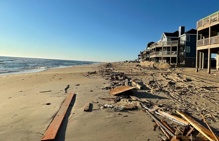
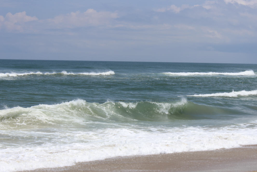
Sections of the collapsed house and its associated debris were seen in the surf line and well beyond. Surfers and mariners are also advised to use caution in these areas.
Wood debris that washes up on the beach might contain sharp, exposed nails, which could cause harm to pedestrians and damage to vehicle tires, officials warned.
Beachgoers who observe chemicals or other hazardous materials are asked to call 252-473-3444 to report it.
Officials said short-term beach closures south of the house site may continue to be necessary. Beach closures will be announced at http://go.nps.gov/beachaccess and via text alert. Text CAHAORV to 333111 to receive text alerts.
Preventative measures
Dare County officials had been working with the owners of the house to demolish or remove the structure from its precarious perch before the structure collapsed.
“We have been in contact with the homeowner over the course of the last year to try to motivate him to implement some action to either relocate the house or completely demolish the house, and I believe the homeowner was in the process of doing all that. But the ocean evidently was working faster than he was,” Dare County Planning Director Noah Gillam told Coastal Review late Wednesday.
The house had not been occupied in about a year, Gillam said. Its septic system had been destroyed during a previous period of extreme high tides or swells. “So, when that happens, we don’t allow a structure to be occupied.”
Since the collapse, county officials have looked at other properties nearby and are letting the owners know that they should take steps against the threat of erosion.
“I was down there this morning with several of our building inspectors and we did canvass the neighborhood,” Gilliam said Wednesday. “We walked up and down Ocean Drive, and we do have a list of several other structures. I can’t say any of them are in immediate threat of collapse, but there are some that we are notifying the property owners that there are things they need to take action on, proactive measures to try to secure steps and decking, in case or in the event that the erosion or high tide does continue to threaten.”
Vulnerable area
The area where the home collapsed has some of the highest erosion rates on the North Carolina coast.
The shoreline at the site of the collapse had moved 284 feet at a rate of more than 13 feet per year on average in the years between 1998 and 2019, according to data from the U.S. Geological Survey’s Digital Shoreline Analysis System. The DSAS is software used to calculate rate-of-change statistics from multiple historical shoreline positions. The data was posted on Twitter by Michael Flynn, physical scientist with the National Park Service Outer Banks Group and a former coastal scientist with the North Carolina Coastal Federation, which publishes Coastal Review.
At the site of the house collapse the shoreline position moved landward 86.5 m on avg at 4.1 m/yr between 1998 – 2019 along the section of shoreline parallel to Ocean Dr in Rodanthe. The beta shoreline forecast tool in DSAS displays continued landward movement next 10-20 yrs #obx https://t.co/SR2Uf18fXq pic.twitter.com/1351LERtkK
— Michael Flynn (@RippleEnviro) February 10, 2022
The house, which was once on private property, was on the National Seashore when it collapsed. That’s because of North Carolina’s doctrine that ocean beaches are in the public trust.
“Even when much of what is referred to as the dry sand beach erodes, the Seashore’s boundary — based on our interpretation of our establishment and all of the deeds — is generally always at least from the low-tide line to the high-tide line,” Hallac told Coastal Review Friday. “Now, even that is a complicated statement, because the low-tide line and high-tide line change over time, right, especially as erosion is occurring. But generally, if you’re within that zone, we consider it Cape Hatteras National Seashore property.”


