Dare County Launches New and Interactive Community Map
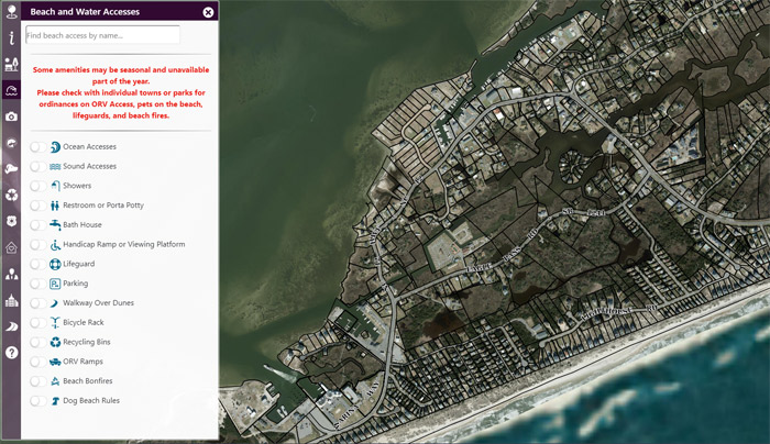
Dare County Geographical Information Services (GIS) recently launched an interactive community map web application. The community map is accessible on any device and provides users the ability to explore Dare County like never before. Based on your location or by looking up an address, users can learn more about community amenities and discover a wide variety of useful information. Filter beach accesses, sound accesses and parks by amenity, get directions to the closest recycling drop-off center, view walking trails and boardwalks, find local attractions, public docks, boat slips or kayak launches and view elected officials and polling locations. Transportation information is also available, including ferry schedules, traffic cameras, and evacuation routes. Access the community map at community.darecountync.gov
If you would like to make a suggestion or addition to the map, please contact GIS Coordinator Greg Ball at 252.475.5831 or gregb@darenc.com.


