Details of 2022 Avon and Buxton beach nourishment projects outlined at public meeting
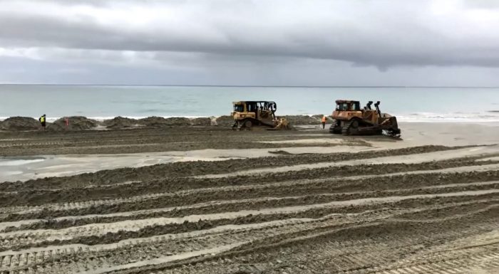
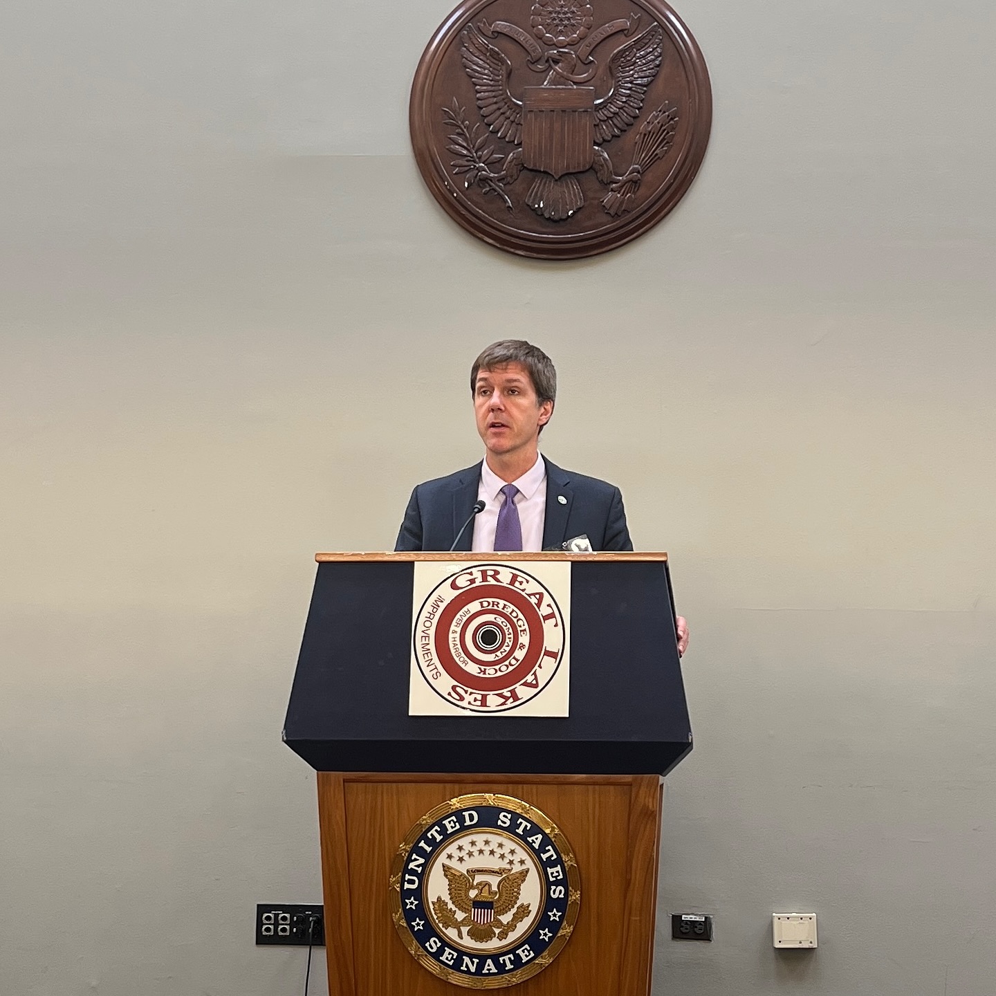
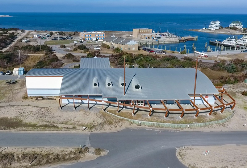
Dare County officials, as well as representatives from contractors Coastal Science & Engineering (CSE) and Great Lakes Dredge & Dock Company (GLDDC), provided an overview of the upcoming beach nourishment projects in Avon and Buxton at a Thursday evening meeting at the Fessenden Center.
The two projects, which have been in the works for years, are slated to begin in the summer of 2022, and both endeavors will take an estimated 40-60 days to complete. With behind-the-scenes plans already underway to set the stage for the ensuing work, the meeting was an opportunity to explain to the public what to expect in the months ahead.
The primary purpose of both projects is to protect N.C. Highway 12 from being destroyed by hurricanes and nor’easters, like after Hurricane Irene in 2011, when the highway was so badly damaged north of Rodanthe that an emergency ferry had to be utilized for weeks. But the projects will also restore erosional hotspots, provide wider recreational beaches, restore sand loss in Buxton that has occurred since the original beach nourishment project was done in 2017, and allow both Avon and Buxton to be eligible for future FEMA community assistance funds, which are only granted to engineered beaches.
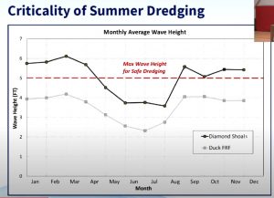
The reason why the projects are done during a summer timeframe is due to the weather and wave heights. The maximum wave height to conduct safe dredging is 5’ feet, and the average wave heights in the summer are typically well below this maximum.
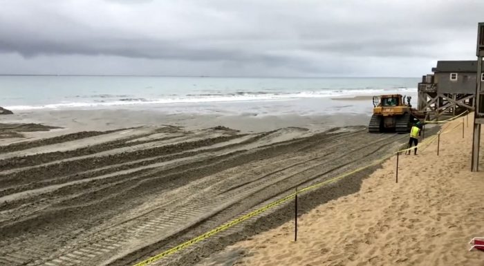
During both projects, sand will be dredged from two borrow pits located approximately two miles offshore, and deposited on the beach via a total of five pipelines before being leveled off by bulldozers and other equipment. The process will initially make the beaches at least 100 feet wide, and flat throughout, but the shape will change as storms and natural weather patterns adjust the topography.
For both projects, Dr. Haiqing Liu Kaczkowski, Senior Coastal Engineer for CSE, provided a detailed update on what the work would entail, and how both stretches of shoreline would be impacted during the project.
Buxton Maintenance Project
The Buxton aspect of the project is a beach nourishment maintenance project, which will add approximately 1.2 million cubic yards of sand to the northern Buxton beaches. The original beach nourishment project, which was completed in February of 2018, deposited a total 2.6 million cubic yards of sand on the designated 2.9-mile stretch of Buxton shoreline.
Dr. Kaczkowski provided an overview of the original 2017-2018 project, noting that while the project stayed within budget, it far exceeded its original estimated timeframe due to several factors. “The [contractor Weeks Marine] estimated to complete the project in three months, but for 50 days, they couldn’t pump at all because the sea conditions prevented them from doing any offshore work,” she said. “And also, if you recall, we had four hurricanes in 2017 – That was a very unusual year for named hurricanes, and one after another occurred within a month.”
For the 2022 project, a hopper dredge will be used to excavate sand from the offshore borrow pit within state waters, (instead of the cutterhead dredge used in 2017), which will likely allow for more dredging time, due to the hopper dredge’s higher tolerance of wave heights and unfavorable weather conditions.
“Our latest survey in August 2021 showed that there is still 25% of nourishment sand [from the original 2017 project] remaining within this project area,” said Dr. Kaczkowski. “The reason why you probably don’t see it is because this [sand] is nearshore or even further offshore, building the bar, but the dry-sand beach has returned to its pre-nourishment condition in 2016.”
The main reason why a maintenance project is needed for Buxton is simply because beach nourishment is not a one-time endeavor, and projects have to be conducted every five years or so in order to maintain a wide beach and a safe and protected N.C. Highway 12.
Like 2017, the primary staging area will be a half-acre site at the end of Old Lighthouse Road in Buxton. “You may see bulldozers, front-end loaders, lots of pipes and fuel tanks, and other things at [the Buxton staging site],” said Dr. Kaczkowski.
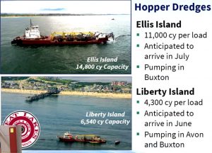
Two dredges will conduct work in Buxton. The Ellis Island dredge, which is expected to arrive in July, will immediately begin working in Buxton, and the Liberty Island dredge will arrive in June and will pump sand to both Avon and Buxton. Once the Buxton project is complete, the county will enlist a contractor to install sand fencing and vegetation after November 15, which is the end of the sea turtle nesting season.
Avon Nourishment Project
The Avon Beach Nourishment project is a new endeavor that will deposit 1 million cubic yards of sand on approximately 2.2 miles of Avon shoreline, from Due East Road to the southern village borer. In 2021, the Dare County Board of Commissioners voted to create a new service tax district in Avon to help fund the project.
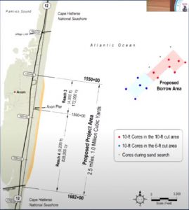
The staging area for the Avon beach nourishment project will be at ORV Ramp 38, which will likely be closed for the duration of the project due to equipment and safety concerns. Dunes will be constructed south of the Avon Pier, but will not be constructed north of the pier where a healthy dune line already exists.
The Avon project will begin before the Buxton project, with dredging by the Liberty Island expected to start in June, although construction activities may occur as early as May as contractor GLDDC prepares for the project.
Easements have been requested by Dare County from some homeowners in the project area in order to add sand to sections of the shoreline that may be past the National Park Service boundary. “We can’t just go dump sand on your property without your permission,” said County Manager Bobby Outten, “and the easement doesn’t allow anyone to go through your yard, or use your yard for access, or any of those kinds of things… We have to start work at the base of that dune, so the [easement says that] we can start there, and work eastward to put sand on the beach, and widen that beach in front of your house.”
Public Beach Access During the Projects
One of the biggest concerns, and primarily for the Avon project, is beach access during the summertime project. Dr. Kaczkowski noted that typically the contractor has a 1,000 ft. closure area on any given day. “But this zone is moving, on the average, every 500 feet per day… so this [closure] zone will move north 500 feet every day.”
In that vein, Dare County Public Information Officer Dorothy Hester noted that the county would have regular updates of the project’s progress and current closures via the county’s website, morebeachtolove.com.
Among the website’s links and information on the various countywide projects are Google maps that outline exactly where construction work and possible closures are occurring, which includes a map for Avon and a map for Buxton.
“One of the features that people really seemed to like in 2017 was being able to use the Google Map to determine if a particular property is in the project area,” said Hester. “So basically, you go to the Project Map, and type in the address, and then it’s going to pin and show you where that property is in relation to [ongoing construction activities.] And we’ll see the colors and activity change as construction starts.”
“It’s a great tool, and people – particularly our visitors – like that feature because they’re trying to figure out [what’s happening] in relation to where they’re going to stay.”
“The contractor will try their best to work around the public,” said Dr. Kaczkowski. “They are very experienced, and have gone through this process many times.”
Wildlife and Sea Turtle Monitoring
Another concern was how construction would impact local wildlife, and particularly endangered sea turtles, which frequent the local beaches in the summer months to lay their eggs. Like the Buxton project in 2017, wildlife monitoring will take place daily, 24 hours a day, and nests will be relocated as needed.
In addition, if the subcontractor biologists conducting the monitoring work spot American oystercatchers, least terns, or other nesting endangered or threatened bird species in the project area, a 1,000 ft. closure will be installed so that the contractor and equipment won’t encroach on the area.
For More Information
Dare County, in conjunction with CSE and Great Lakes Dredge & Dock Company, will provide regular updates on both projects’ status in a number of ways.
The website, morebeachtolove.com, will be a primary resource for information, and the public can also sign up for email updates on both projects, which will be issued when milestones are reached, or there’s a major event. The County will also be working with local media outlets, including Radio Hatteras and the Island Free Press, to provide progress updates as needed.
The complete video of Thursday’s meeting is also available online, and can be accessed via Dare County’s YouTube page at https://www.youtube.com/watch?v=CXnzYOaotwQ.
