Four tropical storms form since Sunday, still nothing expected to threaten Greater Outer Banks
From Wobx.com
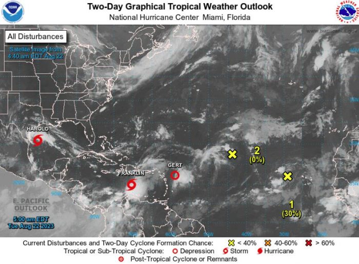
The peak period of hurricane season activity has arrived in full force, with the formation of four tropical storms between the tropical Atlantic and the Gulf of Mexico since Sunday.
None of the current activity is forecast to threaten eastern North Carolina, although there could be some increased long-period swells early next week from what’s expected to become the second hurricane of 2023.
A disturbance moving towards the south Texas coast was upgraded to Tropical Storm Harold, the ninth system this year. That’s after tropical storms Emily, Franklin, and Gert all formed over the last two days.
Emily has since become a remnant tropical wave, while Gert was downgraded to a tropical depression early this morning.
Franklin is forecast to move over Hispaniola and bring flooding rains to the Dominican Republic and Haiti before sliding east of the Bahamas and then out into the open Atlantic south of Bermuda and may become a hurricane over the weekend.
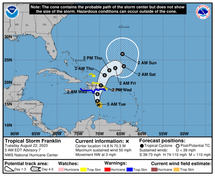
Its eventual proximity to the southeast United States will mean waves generated by Franklin will start impacting our coast by Sunday, with an increased risk of rip currents likely.
Earlier this month, NOAA raised its prediction for activity in the Atlantic basin to be above normal for the rest of 2023.
Dare County and the National Weather Service have scheduled a Hurricane Preparedness Forum for this Wednesday at the Emergency Operations Center on Roanoke Island.


