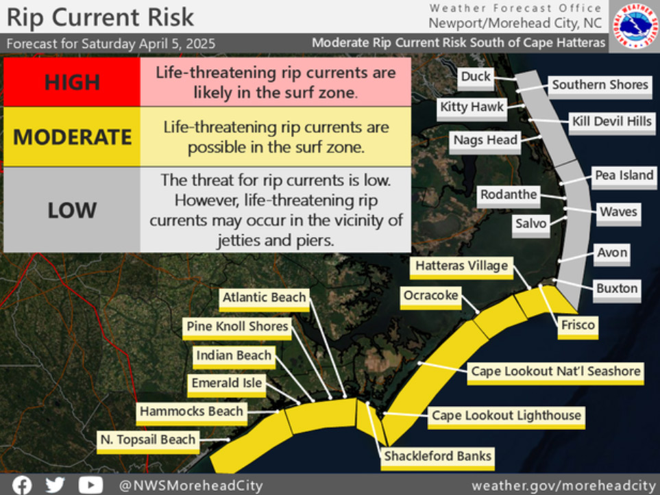
Rip current forecasts resume for the Outer Banks

Another sure sign the season is upon us arrived Saturday morning, as the National Weather Service began issuing their daily rip current forecasts for most of the Outer Banks.
“Figuring out when the crowds will flock to our shores is no easy task with ‘reasonable water temperature’ return dates, school breaks/vacations, and holiday dates changing every year,” said Charlie Bowen, a forecaster at NWS Newport/Morehead City.
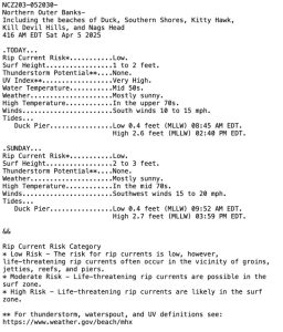
Known as the Surf Zone Forecast Program, the product is issued in the early morning, around midday, and in the evening.
Along with the rip current forecast for the next 48 hours, the report also includes surf height, potential for thunderstorms, ultraviolet index, water temperatures, the weather condition and air temperature forecast for the day, winds, and tide times and heights.
“In an attempt to get something so variable a little more concrete, MHX policy for 2025 and beyond will be to start the “SRF” Program no later than the first weekend in April,” Bowen said.
MHX is the three-letter designation for NWS Newport, which covers the Dare County beaches and Ocracoke.
The reports are also shared daily by email, text and social media through Dare County Emergency Management’s LoveTheBeachRespectTheOcean.com and OBX Alerts program covering the beaches from Duck to Ocracoke.
The 2024 season was also the first for a new flag system along the Dare beaches, with yellow flags indicating medium hazards, a single red flag for high hazards, and double red flags indicating ocean swimming is banned.
Unlike other lifeguard services in North Carolina and elsewhere, Outer Banks agencies have avoided flying green flags at their stands so as to avoid the assumption by some beachgoers that ocean swimming was free of any potential hazards.