Severe Thunderstorm Watch in effect for Hatteras and Ocracoke Islands until 10 p.m. Monday
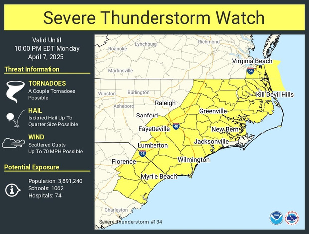
A Severe Thunderstorm Watch is in effect for all of eastern North Carolina, including Dare and Hyde Counties, until 10 p.m. on Monday, April 7, according to an update from the National Weather Service.
The primary threats are damaging wind gusts of 50 mph or more, and the possibility of an isolated tornado or two. Heavy rains are also expected overnight with up to an inch of rain forecast for Hatteras and Ocracoke Islands.
A Small Craft Advisory is also in effect for the Outer Banks until 2:00 p.m. Tuesday.
For more information on the local forecast, visit weather.gov/mhx for general weather information, or the National Weather Service office in Newport/Morehead City’s Facebook page.
To get notified of ferry delays or cancellations, sign up for text and/or email alerts via the N.C. Ferry System’s FINS system at www.ncdot.gov/fins.