Severe weather threat increases from Helene for the Outer Banks, minor coastal flooding possible
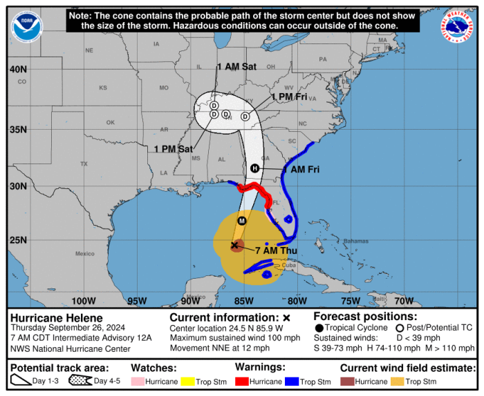
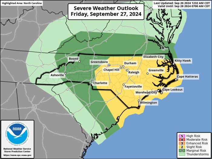
The severe weather threat for eastern North Carolina from Hurricane Helene has increased, as well as the potential for minor coastal flooding on the beaches of Hatteras and Ocracoke, as well as along the sounds, rivers, and creeks in the border counties.
Helene is expected to make landfall this evening along the Florida Panhandle as a category three storm, with what the storm surge forecast for the Big Bend area.
Rain and wind are expected to continue spreading into North Carolina today, with the worst conditions expected in the mountains and Piedmont where a frontal system has stalled and will combine with Helene to create life-threatening flash flooding.
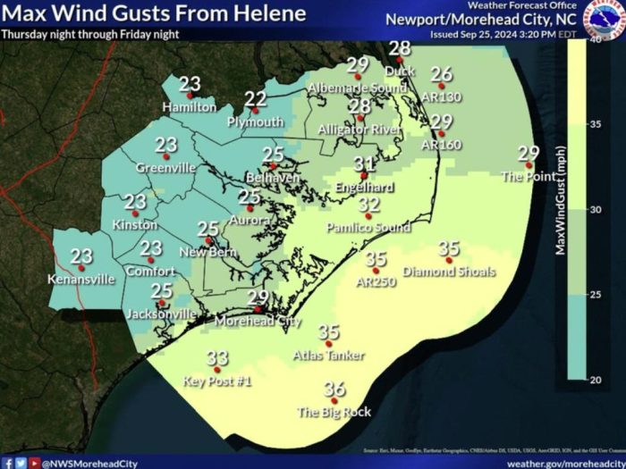
We could see some gusty southeasterly winds, heavy showers and thunderstorms, and maybe even a few tornadoes, mainly on Friday.
A Coastal Flood Advisory continues today for water level rises of one foot above ground from Duck to Ocracoke.
That is unrelated to Helene, but rather due to the continued onshore flow since Labor Day, waves from what is now Tropical Storm Isaac in the far central Atlantic and is on a track away from the United States, and residual elevated tides from last week’s full moon.
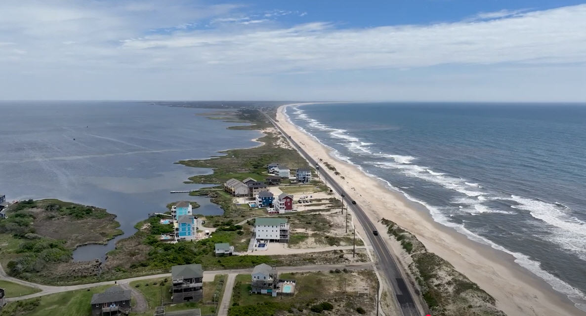
Minor overwash is possible at the usual trouble spots in Rodanthe, Buxton, and the north end of Ocracoke between 1 and 5 p.m. with this afternoon’s high tide.
Southeasterly winds of 20 to 30 mph, with locally higher gusts, are likely, especially over the coastal waters starting early Friday.
That will lead to surf of 4 to 8 feet, and a High Surf Advisory will be in effect for areas south of Oregon Inlet from 3 a.m. Friday to 4 a.m. Saturday.
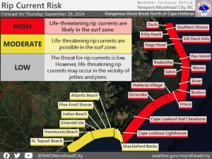
A high risk of rip currents, with powerful shore breaks is posted again on Thursday for all of the beaches. Red flags are flying indicating it is too dangerous to be in the ocean.
Winds from the southeast have already started pushing up water levels in the Currituck and Albemarle sounds and their tributaries.
That is combining runoff from last week’s heavy rains to cause minor flooding in many areas that usually see water from a southerly breeze.
Elevated water levels also continue along the soundside of the Outer Banks. The winds are expected to push the water towards the shorelines along the mainland.
But the sound water won’t be returning with any speed, or rising to flood levels, as winds are forecast to slowly ease as Helene becomes a giant rainmaker while losing its tropical characteristics over the Appalachians and Ohio and Mississippi valleys.
Saturday’s forecast looks to be dry and seasonably warm, with highs in the mid-80s.
A chance of showers and storms returns late Sunday and into Monday as Helene’s remnants move across the area, with highs around 80.
