Confidence high that Dorian will impact the Outer Banks; Mandatory evacuation starts today for visitors
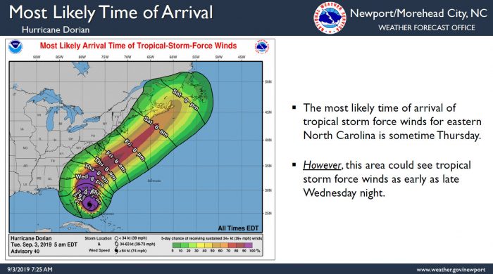
Confidence continues to remain high that Dorian will have impacts on the Outer Banks which could occur as early as Wednesday evening, per a Tuesday morning update from the National Weather Service (NWS) Newport / Morehead City office.
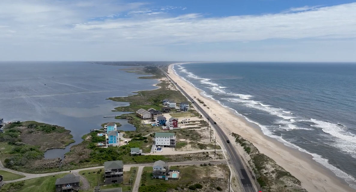
A mandatory evacuation for Hatteras Island and Ocracoke Island visitors is in effect beginning Tuesday, and a mandatory evacuation for all Hatteras Island residents begins on Wednesday.
Dare County Schools will be in regular session on Tuesday, September 3, but will close for all students and staff beginning Wednesday, September 4 through Friday, September 6.
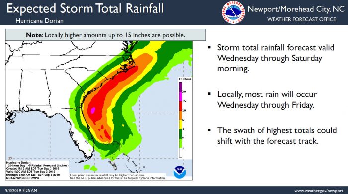
Per the latest briefing from the NWS, the threat for tropical-storm-force winds has increased further, especially along the Outer Banks, where tropical-storm-force wind probabilities are very likely. Up to 15 inches of rain is now forecast from Wednesday through Saturday morning and prolonged periods of heavy rainfall could lead to flash flooding. Storm surge inundation is also a concern, and large swell from Dorian will continue to impact the Eastern N.C. coast this week. A high risk of rip currents will remain in effect all week long.
Per county officials and the NWS, Now is the time to complete your hurricane preparedness plans. All preparations should be completed by Wednesday.
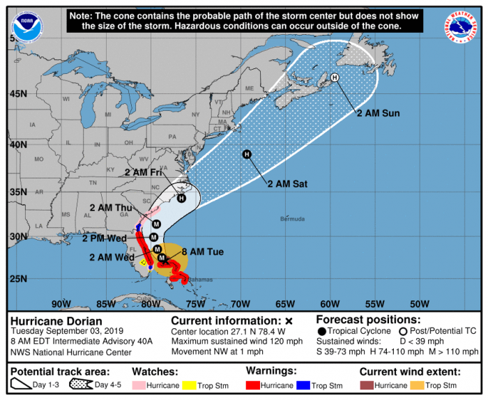
As of 8 a.m. on Tuesday, Dorian was located approximately 110 miles ENE of Palm Beach, Florida with maximum sustained winds of 120 mph. Dorian is beginning to move northwestward at about 1 mph (2 km/h), and a slightly faster motion toward the northwest or north-northwest is expected later today and tonight.
A turn toward the north is forecast by Wednesday evening, followed by a turn to the north-northeast Thursday morning. On this track, the core of extremely dangerous Hurricane Dorian will gradually move north of Grand Bahama Island through this evening. The hurricane will then move dangerously close to the Florida east coast late today through Wednesday evening, very near the Georgia and South Carolina coasts Wednesday night and Thursday, and near or over the North Carolina coast late Thursday.
Some uncertainty still remains in Dorian’s forecast track, so all interests in the Carolinas should continue to monitor this storm using trusted, official sources of information. The public can stay updated with the latest information on Dorian and find hurricane preparedness tips at https://www.nhc.noaa.gov/.
For more information on the local forecast, visit www.weather.gov/mhx for weather information, or the National Weather Service office in Newport / Morehead City’s Facebook page at https://www.facebook.com/NWSMoreheadCity/.


