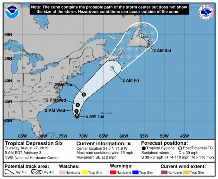
Though Tropical Depression 6 (#TD6) is forecast to stay well offshore, elevated seas and a high threat of rip currents are expected throughout the day, per an update from the National Weather Service Newport / Morehead City Office.
Tropical Depression 6, which is currently located about 365 miles southeast of Cape Hatteras, is expected to have little movement through tonight, then accelerate northward Wednesday to northeastward Thursday through Saturday.
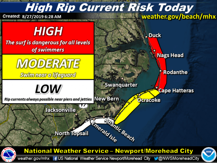
The main impacts for coastal North Carolina will be elevated seas, with a high threat of rip currents for the Outer Banks north of Cape Hatteras, and a moderate risk of rip currents for southern Hatteras Island and Ocracoke Island.
As of 5 a.m. on Tuesday, #TD6 had maximum sustained winds of 35 mph (55 km/h) with higher gusts. Some strengthening is expected during the day, and the cyclone is forecast to become a tropical storm later tonight.
A High Threat of Rip Currents means that the surf is dangerous for all levels of swimmers. The combination of strong winds, strong longshore currents, and rough surf will continue to support a high rip current risk at the beaches throughout Tuesday, and likely into Wednesday.
For more information on the local forecast, visit www.weather.gov/mhx for weather information, or the National Weather Service office in Newport / Morehead City’s Facebook page at https://www.facebook.com/NWSMoreheadCity/.


