With bridge project, concerns arise about power and communications to Hatteras and Ocracoke

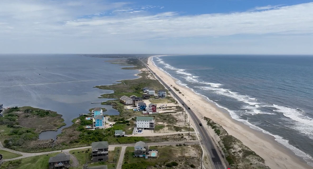
Last week, the North Carolina Division of Coastal Management agreed to allow NCDOT to place sandbags at the north end of Rodanthe at Mirlo Beach. The permit is seen as important for the protection of the subdivision from changes in the shoreline that will certainly occur when the sandbags and dunes, and even the road, are removed from the S Curve area parallel to the Jug Handle Bridge.
But that permit is only one piece of a bigger puzzle and may not even be the most significant. When the protections and road are removed from the S Curve area, critical energy and communications infrastructure could be endangered when forces of nature batter the area along one of the most dynamic stretches of shoreline on the Outer Banks.
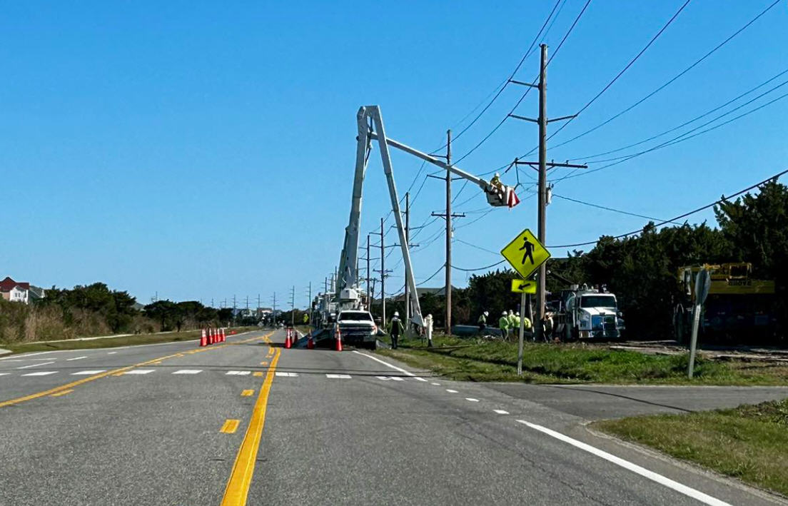
In the Cape Hatteras Electric Coop’s (CHEC) January newsletter, the company hinted at the problem, writing that “The power delivered to Hatteras and Ocracoke Islands is exclusively provided by the transmission line that runs parallel to the existing highway. Once NCDOT completes the Rodanthe bridge…they will immediately begin removing the asphalt, dunes and sandbags that are in the current highway right of way…”
In a Voice interview, Susan Flythe, CHEC Executive Vice President and General Manager, provided more detail.
“That is where our 115 kV transmission line that serves all of Hatteras and Ocracoke islands is located,” she said. “We are concerned about the reliability of electric and broadband service for both Hatteras and Ocracoke with the removal of this road before these essential services can be safely secured to the new bridge.”
Work has begun on moving electrical and communication infrastructure to the new bridge, but because it will be necessary to stagger work around peak traffic times and pause work during the summer, that project is not scheduled to be completed until late 2022.
But, as it now stands, when the bridge opens to traffic, NCDOT will begin removing the sandbags, dunes and road that have provided protection and access to the area. Without those protection or a roadbed, it would be difficult for repair crews to move quickly to restore power and communications if the lines were damaged.
Dare County Commissioner for Hatteras Island, Danny Couch, points out that without the road, repair trucks will not be able to get to the damaged area.
“These trucks are 30,000 pounds. If we can’t access the power line, people are forgetting about the internet and the digital. We are shut down…everything from schools to businesses,” he said.
Sources in NCDOT have indicated that a meeting is scheduled, likely as early as this week, with the various agencies to discuss the issue. Key federal organizations have indicated they are aware there is a problem, and it needs to be addressed.
“There are lots of moving parts and the need for continual interagency coordination when a project of this size is underway,” Dave Hallac, Superintendent of Cape Hatteras National Seashore, wrote in an email. “I understand the need to carry out the plans for completing the Jug Handle Bridge project, and I also understand the importance of maintaining power and communications systems that support Hatteras and Ocracoke Islands.”
With camping areas, visitor centers and most of Cape Hatteras National Seashore located south of the area of concern, a loss of power and communication would have a dramatic effect on National Seashore operations.
Currently NC12 as it passes through the S Curve area, is in a right of way granted to NCDOT by US Fish and Wildlife (USFW), the agency that is responsible for Pea Island National Wildlife Refuge. Part of the agreement granting a new right of way for the Jug Handle Bridge included removing all protections and the road when the bridge opens.
Although USFW has an agreement with NCDOT to remove the protections, in an email from Jennifer M. Koches, Supervisory Public Affairs Specialist for USFW, it is apparent the agency understands there are issues that need to be addressed and that talks about those issues are underway.
“Since discussions on the Rodanthe Bridge Project are ongoing among the U.S. Fish and Wildlife Service and our partners with the North Carolina Department of Transportation (NCDOT) and Cape Hatteras Electric Cooperative (CHEC), it would be premature to offer comment on any decisions to delay road removal,” she wrote. “The Service remains committed to working with NCDOT and CHEC to find reasonable solutions to meet shared concerns about access and utility services and we appreciate our long-standing and positive working relationships with both partners.”
When communication and power are finally rerouted to the Jug Handle Bridge, it will represent a significant upgrade in reliability. But if an agreement on keeping protections and the road in place cannot be reached, Couch worries about a replay of July 2017 disaster when a construction accident affecting the line to Hatteras at the Basnight Bridge brought life to a standstill during one of the big tourism weeks of the season.
“We evacuated 44,000 people the last week in July when the cable got severed,” Couch said. “This is cheap insurance.”







As full time residents of Hatteras Island, we are appalled to learn that no precautions have been made to ensure the seemless transition of power and telecommunications cables from along old Highway 12 to the new Jug Handle Bridge.
It is hard to fathom the short-sighted stupidity of the planners, engineers and/or politicians who have been overseeing this project. Does anyone in charge of this project actually give a care about the residents of Hatteras Island and Ocracoke Island?
Perhaps it is time to vote in some new county and state officials….
We wonder why these issues are just now coming to the attention of tax payers,and residents. Wouldn’t proper planning have precluded this last minute scramble to keep our life-lines intact. Amazing incompetence!