My last blog for December often has a year-end theme of some sort, looking back on the year that is ending or looking forward to the new one.
However, mostly I stay away from the “top news stories of the year” sort of article. For one thing, every writer or media outlet seems to do it. And also, it’s challenging to whittle down a whole year’s worth of news to a few stories.
This year, however, I am going to choose what I think are the top stories of 2015 for this last blog of the year — the top five, at least. The fact that there have been some pretty important, news-making events probably makes it easier.
So here are my choices:
1. The Bonner Bridge.
2. Shark Attacks
3. Weather.
4. Hatteras Inlet Shoaling.
5. Cape Hatteras National Seashore Access
THE BONNER BRIDGE
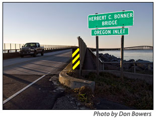
We are finally going to get a replacement for the aging Herbert C. Bonner Bridge across Oregon Inlet. That’s definitely the top story of the year — maybe of the decade.
After a quarter century of planning, studies, bickering, and finally legal challenges from environmental groups, the announcement came on June 16 that replacing the 2.7-mile Bonner Bridge, which was built in 1963 with a useful lifespan of 30 years, was finally going to happen.
All of the parties to the legal wrangling over the new bridge met at the north end of Hatteras Island on that Monday to announce a negotiated settlement that will allow the North Carolina Department of Transportation to move forward — with a new span over Oregon Inlet and solutions to two of the most troublesome areas on Highway 12 in Pea Island refuge.
Even Gov. Pat McCrory flew in for a news conference on a narrow sandy beach on the southside of Oregon Inlet.
The settlement came after nine months of negotiations and ended a lawsuit the environmental groups filed in July 2011 to stop NCDOT’s plan to replace the bridge with a parallel span and address “hotspots” along Highway 12 on Pea Island National Wildlife Refuge in segments as needed at a later date. The groups favored a long, 17.5-mile bridge, which would bypass the refuge entirely and that DOT said it did not have the funds to build.
In exchange for dropping their lawsuit, the Defenders of Wildlife and the National Wildlife Refuge Association — represented by the Southern Environmental Law Center — got an agreement from DOT to consider — and probably build — bridges out in the Pamlico Sound to bypass at least seven miles of the southern end of the Pea Island refuge.
Shortly after the announcement of the settlement, DOT’s “merger team,” composed of representatives from various local, state, and federal agencies announced that its preferred alternative for bridging the S-curves and Mirlo Beach area north of Rodanthe is the “jug handle” bridge that swings out into the Pamlico Sound.
The preferred alternative is a 2.5 mile bridge that will start its swing out into the sound north of the S-curves and rejoin Highway 12 in north Rodanthe. DOT plans public meetings on its preferred alternative in late winter or early spring.
A permanent solution still needs to be chosen for a second “hot spot” on Pea Island at the site of the inlet cut by Hurricane Irene in 2011. DOT had quickly constructed a temporary bridge there in the months after the storm — a structure sometimes referred to as the “Lego” bridge.
When the settlement was announced in June, a contractor was already at work building a permanent longer, higher bridge in the DOT right of way in the refuge.
As part of the settlement, DOT cancelled that contract, at a considerable cost that has still not been made public. It has since started working on a new temporary bridge over the Pea Island Inlet area that will be longer and wider than the old temporary bridge. It will certainly serve travelers along Highway 12 better than the current setup — even if nothing else is done in that area for years.
And it’s uncertain what will be done permanently in the area and when it will happen. DOT has agreed to study bridging the area with another span, which, like the one in Rodanthe, would swing out into the Pamlico Sound — and somehow connect with the Rodanthe “jug handle” bridge.
If that should ever happen, the environmental groups will have achieved seven miles of their 17.5 miles bridge.
Meanwhile, the transportation corridor along northern Hatteras Island is certainly safer and more reliable than it was.
SHARK ATTACKS
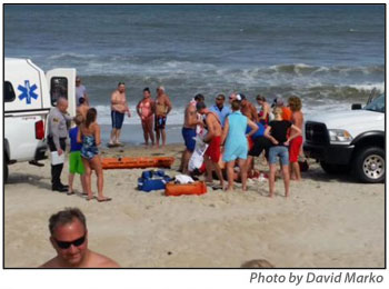
Some prefer to call them shark “bites” instead of “attacks.” But most folks and the media called the encounters between sharks and humans last summer “attacks.”
Indeed, for many it was the summer of the shark, especially in North Carolina, where between mid-June and early July, there were eight reported shark attacks, including three in the Cape Hatteras National Seashore.
The first in the seashore was on June 26 when a 47-year-old man was bitten while he was in the water off the Avon beach, warning swimmers of a shark in the area. The second was an 18-year-old man who was bitten on June 27 while swimming just off the beach in Waves. And, finally, on July 1, a 67-year-old man was bitten by a shark in the water off Ocracoke.
The three bites in about a week’s time garnered plenty of national media attention, especially when added to five other shark attacks that occurred on beaches south of the Outer Banks.
All of this summer’s victims recovered.
And apparently so did all of the seashore’s visitors. For a while, there were very few swimmers in the water off seashore beaches — and in some cases there were fewer folks on the beach.
However, talk of the sharks faded quickly after the last one in early July and were all but forgotten by the end of summer.
Sales, meals, and occupancy tax numbers on the Outer Banks didn’t suffer in the least and some indicators were up considerably over previous years.
Before this summer, the last reported shark bite in the seashore was in 2011 when a 6-year-old girl was bitten by a shark on an Ocracoke beach. She also recovered.
Before that, the last shark attack on the seashore was on Sept. 3, 2001, off the beach at Avon when a 28-year-old Russian visitor was killed and his 23-year-old girlfriend critically injured. A bull shark was suspected in that attack.
Shark experts ticked off any number of reasons for the seemingly sudden increase in shark encounters from warmer water and increased salinity to an increase in food sources, especially with a record number of nesting sea turtles and plenty of baitfish.
WEATHER
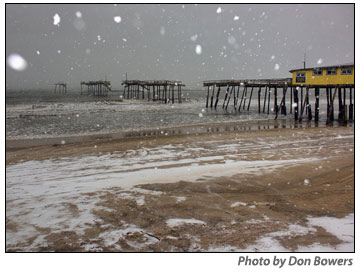
Weather seems to make the top news stories on these barrier islands every year — in one way or another.
In 2015, we had a variety of weather headlines
- Frigid cold weather, coastal storms for winter
- No hurricanes but a threat from a powerhouse of a storm
- Record-breaking rainfall in late September-early October coastal storms
Along about Valentine’s Day, Hatteras and Ocracoke fell into the deep freeze with coastal storms, wind advisories, coastal flood advisories, gale warnings, and frigid temperatures.
Here’s what I wrote in The Island Free Press on Feb. 20:
Heat pumps have been pumping non-stop on Hatteras and Ocracoke for the past few days as record-setting frigid air has poured into the southern U.S. According to the weather forecasters, this is not just your normal Arctic cold — it’s cold all the way from Siberia.
Temperatures started dropping on Hatteras and Ocracoke Wednesday night after a relatively balmy day in the upper-30s. Yesterday’s high was only in the low to mid-20s.
The low temperature for yesterday — Thursday, Feb. 19 — dipped to 19 at Billy Mitchell Airport in Frisco at 11:55 p.m. That was just one degree shy of the record low of 18 set in 1958.
However, records will be broken today on Hatteras — both for the record low minimum and the record low maximum for Feb. 20.
The 13 degrees recorded at 6:51 a.m. this morning at Billy Mitchell was seven degrees lower than the record of 21, set in 1993. Today’s afternoon temperatures are only in the low to mid-20s — sure to beat the previous record low maximum temperature for Feb. 20 of 35, set in 1958.
If you are thinking that February has been colder than it usually is on the islands, you would be correct. Today’s normal high temperature is 54, and the normal low is 40.
The islands also recorded two inches of snow on Feb. 24 that was quite pretty for several hours before temperatures rose above freezing, and the snow turned to rain, washing away our winter wonderland.
Spring did come and with it we had a few early tropical storms pass offshore of the islands, including Ana, which brought some good kiteboarding.
We had no hurricanes in 2015, but after the peak of the tropical storm season, we were seriously threatened for several days with one of the biggest, scariest hurricanes ever recorded in the Atlantic basin.
On the last day of September, Hurricane Joaquin had blown up, seemingly overnight, into a huge tropical system, forecast to become a Category 3 or 4 and North Carolina was smack in the center of the “cone of uncertainty.”
It was headed right toward us, but by late on Oct. 1, forecasters were hopeful it would turn north and northeast, away from the U.S. southeast coast.
That’s what happened, but we still got dumped on here on the Outer Banks. A coastal system, unrelated to Joaquin, brought record rainfall to the southeast U.S., slamming South Carolina but also bringing heavy rain to eastern North Carolina.
From Friday, Oct. 2, until Monday, Oct. 5, the rain came down in sheets at times, blown sideways by the northeast wind, and heavy seas, whipped up by the brush with Hurricane Joaquin, beat against the beaches. Between Friday, Sept. 25, and Tuesday, Oct. 6, more than 17 inches of rain fell on Hatteras Island.
On southern Hatteras and Ocracoke, a surge of water from the Pamlico Sound also flooded the villages and Highway 12.
Many Park Service ramps and other facilities were closed for weeks and even months because of the flooding. Ramp 44 in Buxton was closed from early October until last Friday, Dec. 18.
As we close out 2015, the National Weather Service in Newport/Morehead City, N.C., is forecasting a warm and wet Christmas week, with some high temperatures that will probably break some records. The above normal temperatures are expected to continue into the last week of the year.
HATTERAS INLET SHOALING
The year started with the Dare County Board of Commissioners searching for the funds to get the badly shoaled-up Oregon Inlet dredged and open for business.
In years gone by, the federal government funded dredging in our shallow-draft inlets — Oregon Inlet and Hatteras Inlet in Dare County. However, funding for dredging by the U.S. Army Corps of Engineers has dwindled to nothing, and state and local governments have begun to realize that if they want to keep their waterways open, they are going to have to pay for it themselves.
At one point, legislation introduced by state Sen. Bill Cook would have allowed Dare County to pay for dredging by using occupancy tax money earmarked for beach nourishment. That didn’t go over so well with the towns and other industry groups that are counting on dredging projects in 2016 to widen beaches in Kill Devil Hills, Kitty Hawk, and Duck.
There was some feuding between fishing-related industries and backers of nourishment over funding Oregon Inlet dredging. Eventually, the county did set up a fund to do proactive dredging in Oregon and Hatteras inlets.
However, up until about mid-year, Hatteras Inlet was mostly forgotten in the fray even as shoaling got so serious the state’s Ferry Division had to abandon its traditional route on the Hatteras-Ocracoke ferry and adopt a longer route that took a hour or more rather than the usual 40 minutes.
In the summer, because of the longer ferry route, there are fewer trips, longer lines waiting to board the ferry, and fewer visitors to Ocracoke Island, whose economy heavily depends on these “day trippers.” Some estimate that business on Ocracoke was down by a third this summer.
For a while, commercial, recreational, and charter fishermen managed to navigate the Hatteras channel that was getting more clogged with sand every day so that they could get from Hatteras harbor out to the ocean to fish — which is vital to the economy of Hatteras Island.
Meanwhile, the county had two panels it had formed to deal with shoaling — mostly Oregon Inlet shoaling. They are the Oregon Inlet and Waterways Commission and the Oregon Inlet Task Force. Neither group seemed very interested in the increasing gravity of the Hatteras Inlet situation.
So, Bob Woodard, chairman of the Dare County Board of Commissioners, appointed an ad hoc committee of commission members to investigate the merging of the two panels. Commissioner Beverly Boswell chaired the ad hoc committee, which also included Allen Burrus of Hatteras and Warren Judge.
At its one contentious well-attended meeting in mid-May, the members of the Oregon Inlet Task Force made it clear that they did not want their mission expanded to include Hatteras Inlet shoaling problems. Hatteras should start its own task force, they said.
In the end, the Inlet and Waterways Commission was not dissolved as had been planned but instead voted to continue and expand its mission to include Hatteras Inlet. Beginning in 2016, the group will alternate meetings between Manteo and Hatteras village.
On Aug. 19, the situation was so dire in Hatteras Inlet that the U.S. Coast Guard was warning mariners away from using it and eventually pulled the channel markers.
Suffice it to say that the area that needed dredging was a bureaucratic “no man’s land.” The Army Corps said it couldn’t dredge there because it didn’t have the authority it requires from Congress.
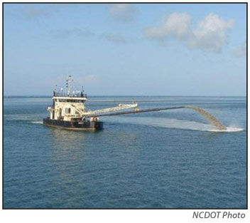
Finally, in November the state-owned dredge began working in Hatteras Inlet. The sand that is being pumped out of the channel is being taken to a dredge spoil site on northern Ocracoke and will be used to rebuild dunes that were damaged in October’s coastal storm.
The dredging work is scheduled to be finished in January.
Meanwhile, at its Dec. 7 meeting, the Board of Commissioners took another step toward clearing bureaucratic roadblocks to dredging Hatteras Inlet.
The board adopted a resolution in support of a letter sent by state Sen. Bill Cook to the U.S. Army Corps of Engineers asking it to amend the existing federal authorization to be more inclusive of the entire waterway that is known as Hatteras Inlet.
Because of changes to the inlet over time, the current federal authorization, established in the 1940s, has boundaries that are no longer relevant
A resolution, signed by Chairman Bob Woodard, was sent to the U.S. Army Corps of Engineers, as well as state and federal entities, urgently requesting the expansion of the federal authorization to include all channels between Hatteras Island and Ocracoke Island and to also include the Inlet Gorge and the sandbar for access to the Atlantic Ocean.
The expansion, the resolution says, is a matter of public safety and economic necessity.
The current dredging is a short-term fix, but Hatteras Inlet still needs a long-term fix, which is still not within reach.
CAPE HATTERAS NATIONAL SEASHORE ACCESS
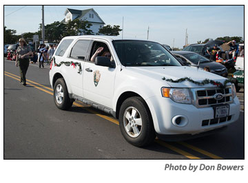
The Cape Hatteras National Seashore had an entry in this year’s Hatteras Village Christmas Parade. It was simple — a National Park Service vehicle with some holiday trimming on it and a few staff members marching along behind — one was decked out as the Cape Hatteras Lighthouse.
Nothing fancy. It didn’t win any awards. But I can’t remember in several decades of Hatteras Village Christmas Parades that the Park Service ever had an entry — at least not in recent times.
In fact, for a number of years not so long ago, there were signs at area businesses that Park Service personnel were not welcome. For the most part, many Park Service employees on Hatteras Island mostly kept a low profile — no marching in parades.
All of that began changing with acting Superintendent Kym Hall, who was at the seashore from August through November 2014 after Barclay Trimble left to take a job in Southeast Regional Headquarters in Atlanta.
Many folks thought Hall was a breath of fresh air. She spent a lot of time trying to mend broken relationships with the community. And, in some cases, she succeeded.
Of course, in fairness, she was here only for a few months and then left, not having to live with whatever she said to folks she met with.
However, she was followed by David Hallac, who arrived to take over his new job as superintendent in early January of this year. He’s attacked his new job with a gusto and optimism that’s been missing around these parts.
In the past 12 months, Hallac has been everywhere, it seems. He’s met with all kinds of user groups, community members, business owners, and just plain folks. He is very accessible. He answers calls and e-mails promptly. He goes everywhere he is invited — to any meeting, interview, or whatever.
And he does all of this with an amazing enthusiasm that seems to have spread throughout the Outer Banks Group. Everyone seems happier and more accessible.
That, and legislation passed in December 2014 by Congress, have made some difference in access for both drivers and pedestrians to seashore beaches during this year, and promises to make more difference next year, especially during nesting season.
Don’t get me wrong. We have not made large strides in access. We will continue to have an Off-Road Vehicle Plan and it will continue to include rules that many of us don’t like.
However, the legislation and Hallac’s speed and attitude addressing its requirements have made small differences in how many of us perceive both the rule and seashore management.
The closure of Cape Point for months each late spring and summer will continue to be frustrating, but every little access change to allow corridors for ORVs and pedestrians is a small step forward. It will continue to astound some of us that Cape Point has to remain closed for several extra weeks at the end of the nesting season — because there is one lone oystercatcher chick still hanging out around there.
But those are the laws that Hallac and his staff have to uphold, although they have made it clear that they are all thinking of every legal way to allow us just a little more access.
Personally, I like that, though I know that some still despise everything about the ORV plan.
I’m not going to devote a lot of space in this blog explaining the various requirements of the Congressional legislation and how well they have or have not been met by the seashore staff. I just did that in a blog a couple weeks ago, and we’ve published dozens of stories in the Island Free Press about the legislation throughout the year.
FOR MORE INFORMATION
If you have an interest in learning more about any of these top five stories, check out The Island Free Press Archives. Scroll down on the Front Page and click on the teal-colored bar that says “Archives.” You will find every story we have published and you can find them listed chronologically year by year and you can Google them by subject matter.
RELATED ARTICLES
Here is a selected background story to go with each of the top five news events:
Moving forward with the Bonner Bridge replacement
Shark experts say warm water, plentiful food figure into spate of attacks.
Reflections on two weeks of wicked weather
Reviewing the new superintendent’s first year at the seashore


