Changes to land from coastal storms can enhance habitat
Considering the growing prevalence of drone photography and video footage over miles of natural landscape, a bird’s-eye view has been proven to be more than eye candy in determining climate impacts. But for wildlife managers at Pea Island National Wildlife Refuge, a major stopover for migrating waterfowl and shorebirds, the compact low-flying machines are also competitors for feathered fliers’ airspace.
That’s why a recent paper analyzing nearly a decade of aerial photographs of the Outer Banks refuge used images taken by a standard airplane to discern how the island is evolving.
The report, “Land cover changes on a barrier island: Yearly changes, storm effects and recovery periods,” was the first to develop a method for quantifying landscape change on barrier islands, and by extension, changes to different kinds of wildlife habitat. The paper, published Sept. 16 in Applied Geography, also revealed that storms that may be destructive to human infrastructure can at the same time enhance habitat for coastal wildlife.
“Quantifying land cover changes in long- and short-time scales and recovery periods is important for land management purposes and to gain a better understanding of the connection between physical, biological, and environmental processes driving the evolution of coastal regions,” according to the paper.

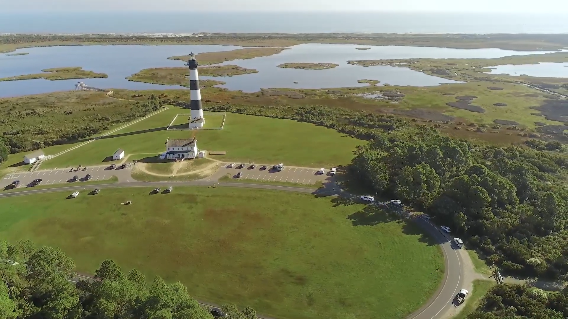
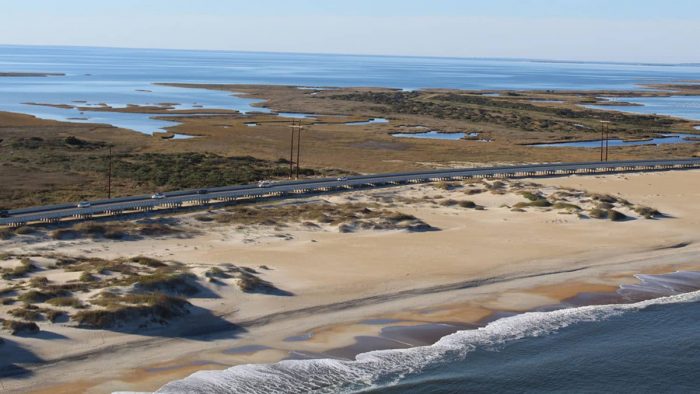
Although researchers focused on Pea Island National Wildlife Refuge, located on Hatteras Island between Oregon Inlet and Rodanthe, the methodology is applicable to other coastal barrier islands. Detailed, color-infrared images taken from 2011 through 2018 were used by researchers to calculate changes every year in land cover and create terrain models, according to a Sept. 28 press release from North Carolina State University. The team was then able to assess changes in topography across the island, and how land responded to storms and how long it took to recover. Land was divided into a dozen categories, such as beach, marsh and estuarine pond, and each was measured every April.
The aerial photography, which is done by North Carolina Department of Transportation, has not been limited to the parameters of the study timeline.
“We are continuing to get the data,” Beth Sciaudone, a research assistant professor of civil, construction and environmental engineering at N.C. State and a co-author of the paper, said in an interview.
Although satellite images are useful in detecting different land vegetation and changes from storm damages, she said that aerial photographs taken by planes provide better resolution.
Pea Island has been the subject of numerous studies over the years, but this is the first time a study has combined topography and high-resolution imagery taken on a frequent basis, she said.
“We are literally counting up the number of acres of marsh versus dunes versus ponds, and providing kind of hard numbers rather than, ‘Yes, we know that the beach has been eroding. We know that the sand dunes have been eroding,’” Sciaudone said. “But now we’re able to put numbers on it.”
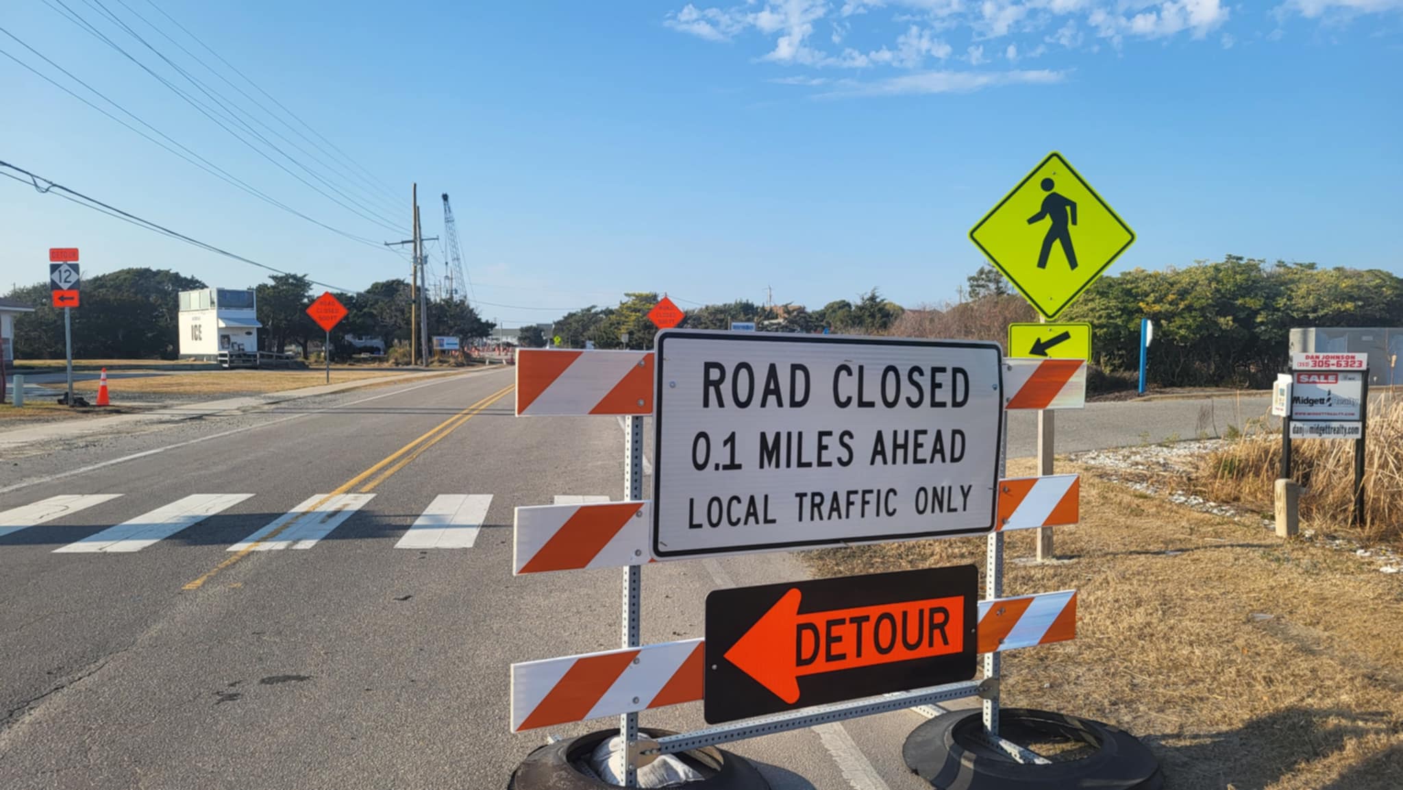
The images revealed how dramatically Hurricane Irene in 2011, and Hurricane Sandy in 2012, altered the Pea Island refuge, especially Irene. The storm overwashed the road in Rodanthe, flooding the pavement, flattening dunes and destroying part of the road. But further north, an inlet was ripped open not far from the refuge’s visitor center. Within a short time, much of the water disappeared, leaving a sand flat that was attractive nesting areas for shorebirds. But the photos show the area is becoming more vegetated.
The project, the genesis of which goes back to the N.C. 12 Transportation Management Plan for the Bonner Bridge replacement, was done with support from NCDOT.

“It’s a science-based approach to understanding how some of these changes are happening — and we see that in real time,” Rebecca Harrison, coauthor of the study and supervisory refuge wildlife biologist at the refuge for the U.S. Fish & Wildlife Service, said in an interview.
“So, I think everybody knows that this place is changing, and thinking about how that impacts our different areas of interest, collectively, I think, really lends power to creative problem-solving, and considering potential solutions for that.”
Liliana Velasquez-Montoya, an assistant professor at the U.S. Naval Academy who worked on the project while a postdoctoral researcher at N.C. State, is corresponding author of the paper. Coauthors also include Margery Overton, a professor of civil, construction and environmental engineering at NC State.
Overton, among numerous experts from, among others, NCDOT, the U.S Fish and Wildlife Service and East Carolina University’s Coastal Studies Institute, is a member of the Coastal Monitoring Team, a product of the N.C. 12 Transportation Management Plan. It is an expanded version of a monitoring project Overton and N.C. State coastal scientist John Fisher conducted on impacts of the terminal groin built on the south side of Oregon Inlet in 1991 to protect the Bonner Bridge and the road from erosion.
Starting in 1997, planning for replacement for the then-34-year-old bridge was encumbered by disagreements and legal actions between agencies and conservation groups, and many of the issues were centered on impacts to habitat and resources at Pea Island. An exquisitely fragile strip of sand perched inches above sea level between the Atlantic Ocean and Pamlico Sound, the refuge is frequently beset by powerful tropical storms and beach-pounding nor’easters.
With the sole highway on Hatteras Island bisecting the refuge, by necessity transportation and refuge officials, along with those of other stakeholder agencies, had to work together to protect their turf and move projects forward.
Eventually they developed mutually effective partnerships, Harrison said. Among them, she added, is the Coastal Monitoring Team, some members of which branched out to work on the Pea Island paper. Others are also members of the most recent iteration of the N.C 12 Task Force that is focused on protecting the road from the effects of sea level rise and other climate change impacts.
The replacement bridge over Oregon Inlet that links N.C. 12, named the Marc Basnight Bridge, was completed in 2019.
“Just the proximity of us thinking about these issues together across agencies — even when our missions are different —- the communication and the partnership has really been incredible to expand our opportunities for these collective things,” Harrison said.
One excellent example of the beneficial collaboration between NCDOT and the refuge was a complicated situation with endangered sea turtles nesting on top of the dunes. When the refuge biologists were trying to devise ways to divert a real risk of the turtles and hatchlings heading toward the highway instead of the ocean, NCDOT personnel came to the rescue by rigging up a blockade from bridge debris that guided the turtles to the sea rather than certain demise under tires.
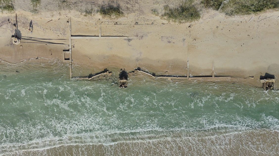
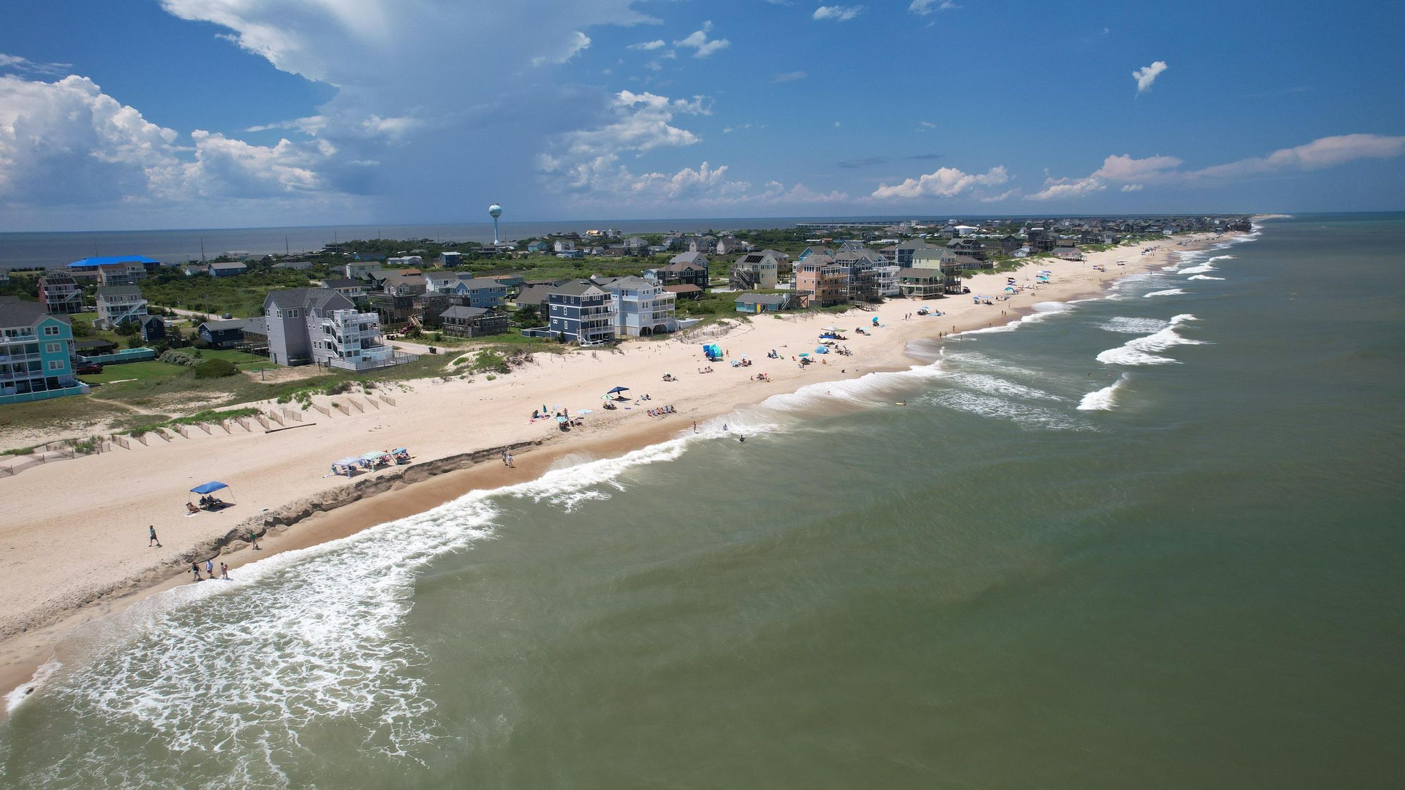
One of the surprising observations the images showed, Harrison said, is that on the ocean side of the island, there is a 2-mile stretch of beach that is extraordinarily narrow, considering that the island there is wide. It was also interesting, she added, that the amount of marsh on the sound side of the island appeared more extensive than she had realized.
Erosion on both sides of the island is a concern for maintenance of the transportation corridor as well as habitat for birds and other wildlife, and will continue to be monitored, Harrison said.
Sea level rise has also elevated attention to the need to adjust future management of the refuge’s impoundment ponds, where migrating birds flock in the spring and fall.
“It’s definitely on the refuge’s radar,” she said. “I don’t think we have a good, simple answer for that right now other than we’re evaluating what kinds of strategies to use in the face of these changes and additional projected climate change.
“Is there any opportunity for restoration, or is it more of a retreat scenario or an adaptation scenario?”
And now the refuge managers have a new methodology by using aerial images to inform their future decisions.


