Hurricane Watch in effect for the Outer Banks
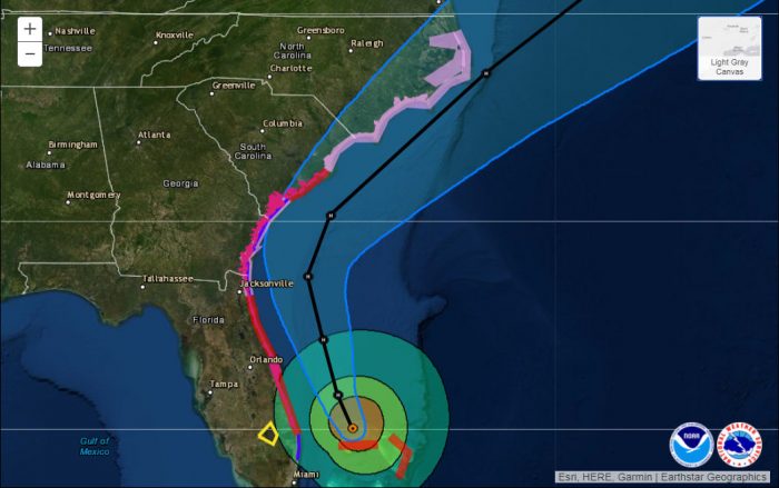
A Hurricane Watch is now in effect for Hatteras Island, Mainland Dare, Northern Outer Banks, Ocracoke Island, Mainland Hyde, Beaufort, Jones, Northern Craven, Pamlico, Southern Craven, Tyrrell, and Washington, per a Tuesday update from the National Weather Service (NWS.)
Hurricane Dorian remains a dangerous hurricane and is expected to move along the Southeast Coast Wednesday, approaching the North Carolina coast Thursday and Friday.
There is still some uncertainty regarding the exact forecast track, but significant impacts are expected across Eastern North Carolina. A slight shift in the track could change impacts drastically. Regardless, this is a very large system and impacts will be felt well away from the center.
Potentially life-threatening storm surge impacts are expected with Hurricane Dorian. Based on the current forecast, inundation of 4 to 7 feet above ground will be possible from Surf City to Cape Lookout.
Life-threatening storm surge impacts are also expected along areas adjacent to the Southern Pamlico Sound, including the Neuse, Pamlico, and Pungo Rivers and isolated areas across the Southern Albemarle Sound.
A small shift in the track could change what locations may see the most significant inundation.
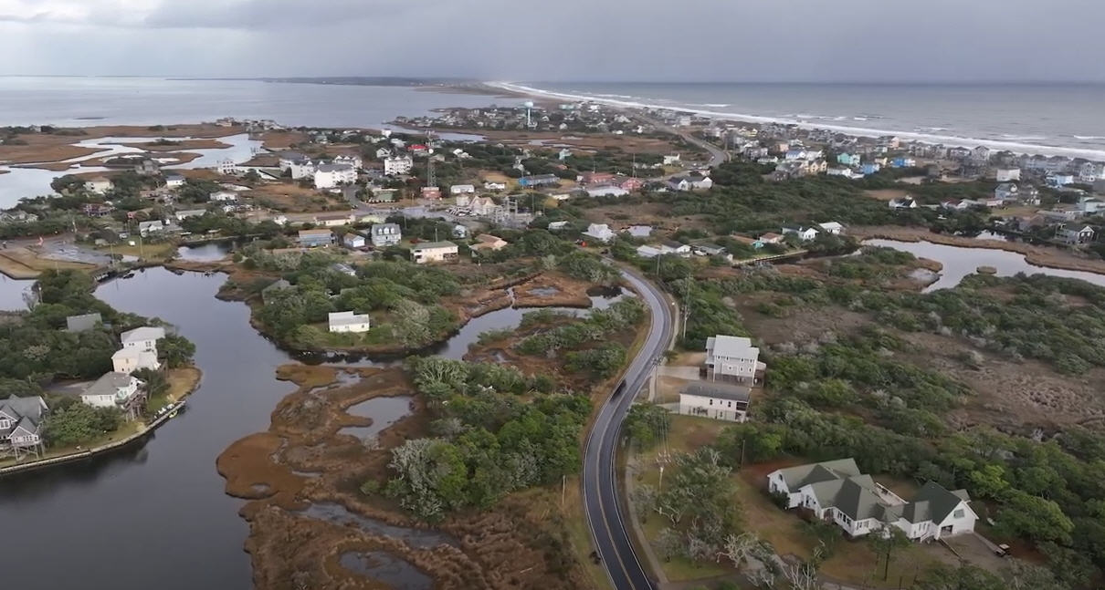
Very high surf and large breaking waves will likely result in moderate to significant beach erosion and ocean overwash along the North Carolina coast Thursday and Friday. Overwash and sound side flooding will likely cause issues on Highway 12 on the Outer Banks Thursday and Friday. Vulnerable areas could experience erosion at multiple high tide cycles.
Hurricane Dorian will produce very heavy rainfall across Eastern North Carolina, with moderate to significant impacts possible. Current forecasts show rainfall amounts ranging from around 5 inches over the coastal plain, to 15 inches or more along the coast. These heavy rainfall amounts in a relative short period of time will likely produce flash flooding across Eastern North Carolina Thursday through Friday afternoon. That being said small changes in the forecast could shift the heaviest axis of rainfall further inland or just off the coast, so continue to monitor the latest updates
The strongest winds are expected Thursday night into Friday morning. Tropical-storm-force winds could develop as early as Wednesday night, with winds peaking Thursday evening into early Friday morning.
Hurricane-force winds will be possible, especially for areas along the coast. These strong winds will have the ability to knock down trees, weak structures, and cause widespread power outages.
Very dangerous marine conditions are expected with seas 15 to 25 feet and higher. A high threat of rip currents will continue for all area beaches and it is advised to stay out of the water.
As of noon on Tuesday, Dorian was located about 590 miles south-southwest of Buxton, N.C.
For more information on the local forecast, visit www.weather.gov/mhx for weather information, or the National Weather Service office in Newport / Morehead City’s Facebook page at https://www.facebook.com/NWSMoreheadCity/.


