Severe weather possible starting Sunday night

A strong cold front will bring the potential for severe weather, strong winds, and locally heavy rains starting Sunday night, according to an update from the National Weather Service (NWS).
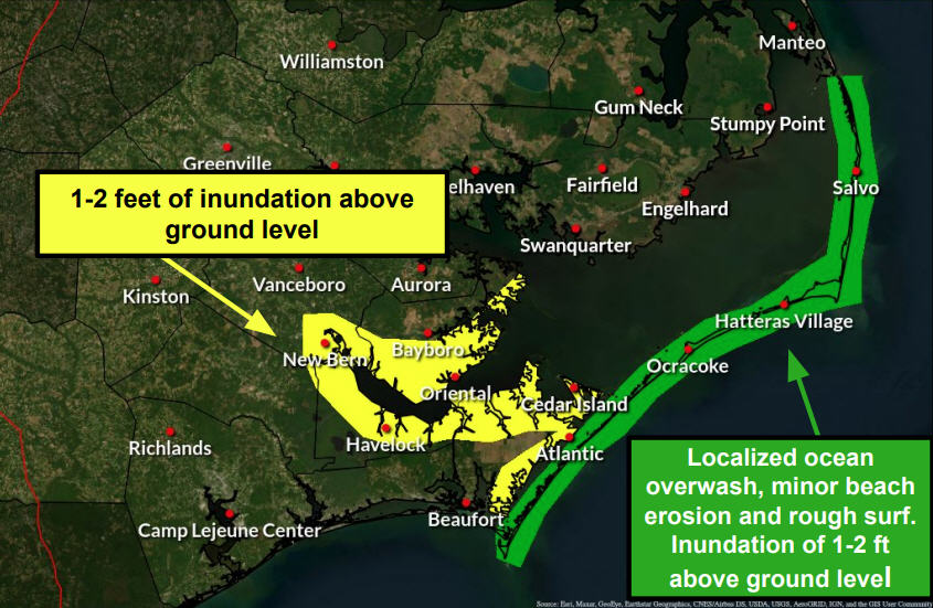
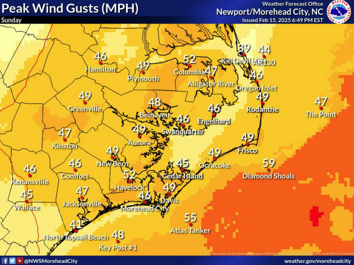
The main threats are damaging wind gusts of 50-70 mph and localized flooding in areas with poor drainage. An isolated tornado or two is also possible.
Multiple rounds of heavy rains are expected Sunday night through Monday morning with 1.5-2 inches of rain forecast for the Outer Banks. Rainfall totals as high as 3-7 inches will be possible in areas where thunderstorms are the most persistent.
The most likely timing for severe weather along the Outer Banks is from 10 p.m. until 6 a.m. Monday. “Nighttime severe weather can be especially dangerous, so please have multiple ways to receive warnings,” stated the NWS in a Sunday morning update.
For information on the local forecast, visit weather.gov/mhx for general weather information, or the National Weather Service office in Newport/Morehead City’s Facebook page at https://www.facebook.com/NWSMoreheadCity/.